Park overview
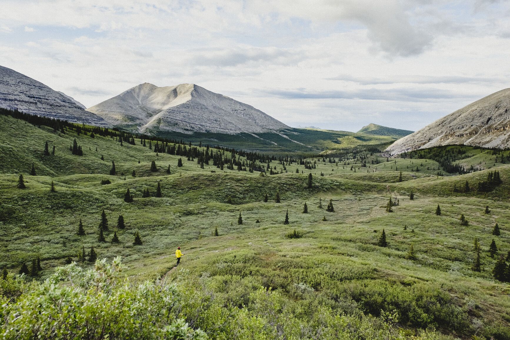
Stone Mountain Park covers 25,691 hectares of remote, mountainous terrain along the Alaska Highway, in the northern Rocky Mountains. Travellers passing through the park can enjoy spectacular landscapes and incredible wildlife viewing opportunities. Backcountry hiking routes offer experienced outdoorspeople access to valleys containing picturesque alpine meadows and lakes.
Advisories
Dates of operation
The park gate is open May 1, 2024 to September 15, 2024
- Facility type
- Frontcountry camping
- Number of campsites
- Vehicle-accessible sites: 28
- Main operating season
- 2024: May 1 to September 15
- Winter season
- Not known
- Winter season note
- Gate is closed when snow falls.
- Note
- Check the advisories above for park alerts and closures.
- Winter season note
- Campground gate may open late or close early due to snow fall.
Safety info
General safety info
- Weather conditions can change quickly in Stone Mountain Park, so be prepared for all conditions when hiking or camping here
- Always carry first-aid equipment and extra clothing and food when hiking in this park
Backcountry safety info
Stone Mountain Park offers significant backcountry hiking and camping opportunities. The term ‘backcountry’ refers to an area more than 1 km away from a highway or park road.
Take extra care when visiting any backcountry area. Stone Mountain’s remote terrain is home to potentially dangerous predators. Emergency response times will be significantly longer than in the frontcountry.
When visiting Stone Mountain, pay particular attention to the following advice:
- Before setting out on a backcountry expedition, leave a detailed trip plan with a friend or family member
- Bring a satellite communication device, an extra day’s-worth of food and other supplies, and a first aid kit
- Water sources in the backcountry may carry giardia and other parasites, so boil or filter water before use
- Educate yourself on wildlife safety practices, securely store anything that might attract animals, and always carry bear spray
- Follow campfire safety best practices and always observe campfire bans (for more information, see the campfires section, below)
For detailed on how to stay safe in remote areas, see the backcountry guide page.
Special notes
- The flora of Stone Mountain Park is fragile due to severe weather and a short growing season. Always tread carefully and lightly when hiking here.
- Camping fees must be paid in cash. Credit and debit cards are not accepted at this park.
Camping
Stone Mountain park offers vehicle-accessible campsites in the Summit Lake area. Sites are available on a first come, first served basis only. Campsite reservations are not accepted.
Camping fees must be paid in cash. Credit and debit cards are not accepted at this park.
Fees
| Vehicle-accessible camping fee | • $20 per party per night |
|---|---|
| BC Senior Camping Discount rate* | • $10 per party per night |
*The BC Senior Camping Discount is only available from the day after Labour Day until June 14, to qualifying parties. Learn more about the BC Senior Camping Discount, on the camping fees page.
Wilderness camping is allowed in the backcountry of Stone Mountain Park. The term ‘backcountry’ refers to an area more than 1 km away from any highway or park road. ‘Wilderness’ refers to any backcountry area with no facilities.
There are no formal backcountry campsites in Stone Mountain Park. When looking for an area to camp in, choose a location where you will have a minimal impact on the environment.
Any time you visit backcountry and wilderness areas, follow Leave No Trace outdoor ethics. For details, see our backcountry guide or visit the Leave No Trace Canada website.
Take particular care to securely store food and anything else that might attract animals to your campsite. Always carry bear spray when hiking in the backcountry. For more information, see the wildlife safety page.
Follow campfire safety best practices and always observe campfire bans. Do not gather wood or destroy vegetation for use in campfires. For more information, see the campfires section, below.
Campfire bans are becoming increasingly common. Check for bans or restrictions on the BC Wildfire Service website and on local or Indigenous government sites.
Facilities
Accessibility information is available for this park.
Cold-water taps are located throughout Stone Mountain Park. Taps are shut off during the off-season.
Stone Mountain Park has a single boat launch, which is on the shore of Summit Lake. You can access this by driving through Summit Lake Campground. The boat launch is on rocky ground and is not maintained.
Campfires are allowed, and a fire ring is provided at each vehicle-accessible campsite. We encourage you to conserve wood and protect the environment by minimizing campfire use and bringing a stove for cooking.
Firewood can be purchased in the park. For information on firewood prices and availability, contact the park operator. See the park operator contact details, below.
Do not gather wood or destroy vegetation for use in campfires. This is an offence under the Park Act. Dead wood is an important habitat element for many plants and animals, and it adds valuable organic matter to the soil.
Campfire bans may be in place. Before lighting a fire, check for bans or restrictions on BC Wildfire Service and on local or Indigenous government websites.
Stone Mountain Park has a day-use and picnicking area. It is at the far end of the campground next to Summit Lake.
Stone Mountain Park only has pit toilets. There are no flush toilets in this park.
Activities
Stone Mountain Park offers a wealth of hiking opportunities. Several frontcountry hikes start from the Summit Lake Campground area. For more adventurous hikers, multi-day hikes lead into the Stone Mountain backcountry and the Wokkpash area (part of Northern Rocky Mountains Park).
Obey any rules posted on signs and stick to designated trails. Taking shortcuts destroys plant life and soil structure.
Frontcountry hikes
Erosion Pillars Trail
At just over 1 km long, Erosion Pillars Trail is suitable for a variety of ability levels. The trailhead is across from Rocky Crest Lake. This trail is named for the tall, thin spire of rocks that can be viewed at the end of the hike.
Summit Peak Trail
The Summit Peak Trail is a 5 km round-trip hike through lodgepole pine forest. It leads to a spectacular view of the park’s alpine area. This trail is recommended only for physically fit hikers.
Flower Springs Trail
The Flower Springs Trail is a 5.7 km round-trip. It includes views of alpine lakes, flowers, and waterfalls.
Backcountry hikes
Only experienced backpackers with map-and-compass skills and proper equipment should attempt backcountry hikes in this park. You will need to camp overnight to complete either of the hikes described below. For more information, see wilderness camping, above.
Topographical print maps are essential for both these hikes or any backcountry excursion in the Stone Mountain and Wokkpash areas. Do not rely on electronic devices that may not function in remote areas. This area is covered by maps 94K/7 and 94K/10 at a 1:50,000 scale.
These areas have dangerous and aggressive predators and longer emergency response times. Bring a satellite communication device, bear spray, an extra day’s-worth of food and other supplies, water purification, and a first aid kit.
Always leave a detailed trip plan with a friend or family member. For more information on safe and responsible wilderness hiking, visit our backcountry guide page.
Visit the Tourism Northern Rockies website for more backcountry hiking information and a published guide to the hiking trails.
MacDonald Creek Valley Trail
The MacDonald Creek Valley Trail is a 35 km hike in the Stone Mountain backcountry. Plan to spend two-to-five days to complete this trail in full. The trailhead is near kilometre 632 of the Alaska Highway. You will find it across from Baba Canyon, 3 km west of Rocky Crest Lake.
Wokkpash Valley-MacDonald Creek Loop Trail
The Wokkpash Valley-MacDonald Creek Loop Trail is 70 km in total. It provides access to the most spectacular parts of the Stone Mountain and Wokkpash areas. Plan to spend five-to-seven days completing the loop.
This trail is a remote wilderness trek intended for experienced hikers. Be prepared for bad weather. There are creek crossings with high water levels prone to flash flooding that could leave you stranded or washed away.
We recommend starting from the Old Churchill Mine Road at km 645.25 of the Alaska Highway. Cross MacDonald Creek and travel 17 km down the road to find the trailhead.
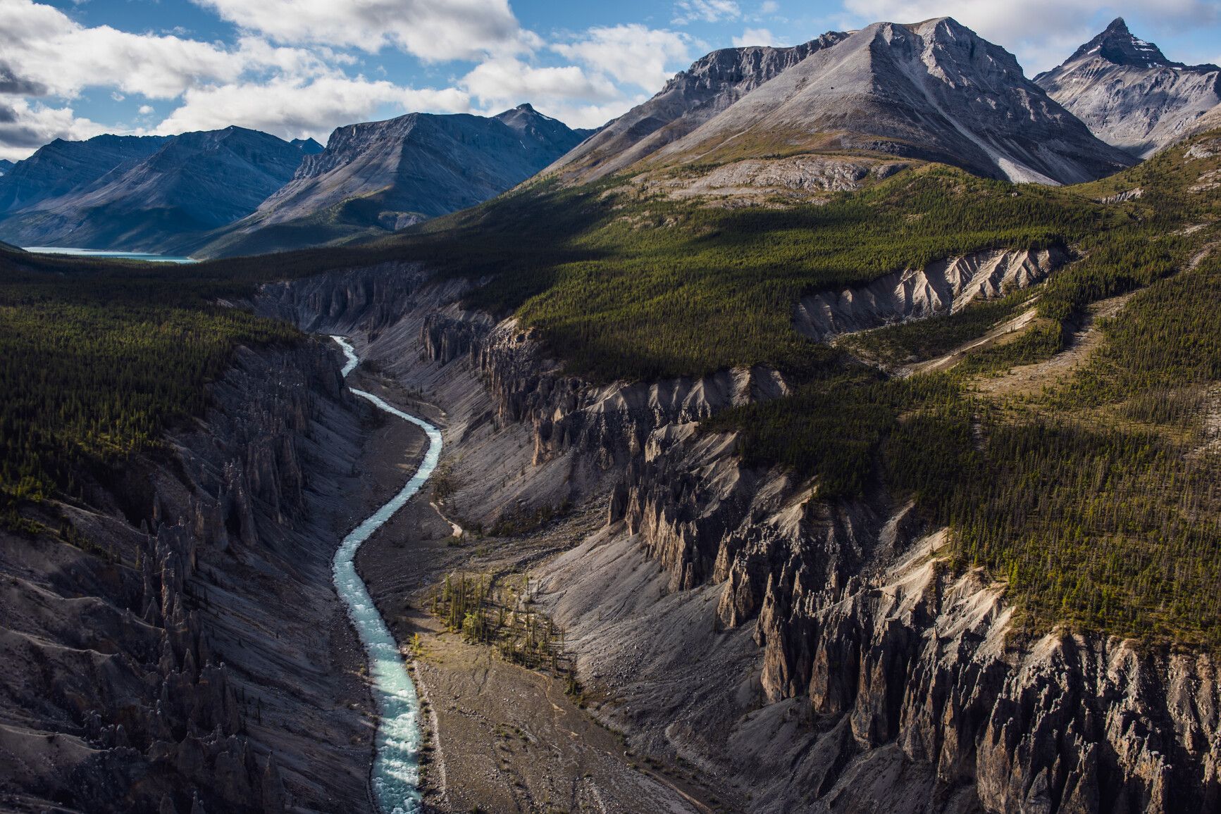
The trail follows Wokkpash Creek, then travels up through the trees above Wokkpash Gorge to reach Forlorn Creek. From here, follow Wokkpash Creek to travel around the east side of Wokkpash Lake to Plug Creek.
Follow markers and cairns to the pass behind Whitestone Ridge. Travel along the valley on the east of Whitestone Ridge to Last Call Lake, then along MacDonald Creek. The trail ends at Babba Canyon near kilometre 632 of the Alaska Highway.
Summit Lake provides opportunities for peaceful canoe trips.
Summit Lake provides opportunities for peaceful kayak trips.
In recent years, Summit Lake has been stocked with rainbow and lake trout. Mountain whitefish are also present. Arctic grayling can be caught along MacDonald Creek. Summit Lake is less productive, with fish growing slowly and maturing late.
Fish populations in this park are easily overfished. Please use good judgement and refer to the current freshwater fishing regulations synopsis [PDF].
Anyone fishing in British Columbia must have an appropriate licence. To learn more, see the fishing and hunting guide.
There are many wildlife viewing opportunities in Stone Mountain Park. The most common fur-bearing mammals are squirrel, hoary marmot, and chipmunk. In the summer, mule deer and elk are also present.
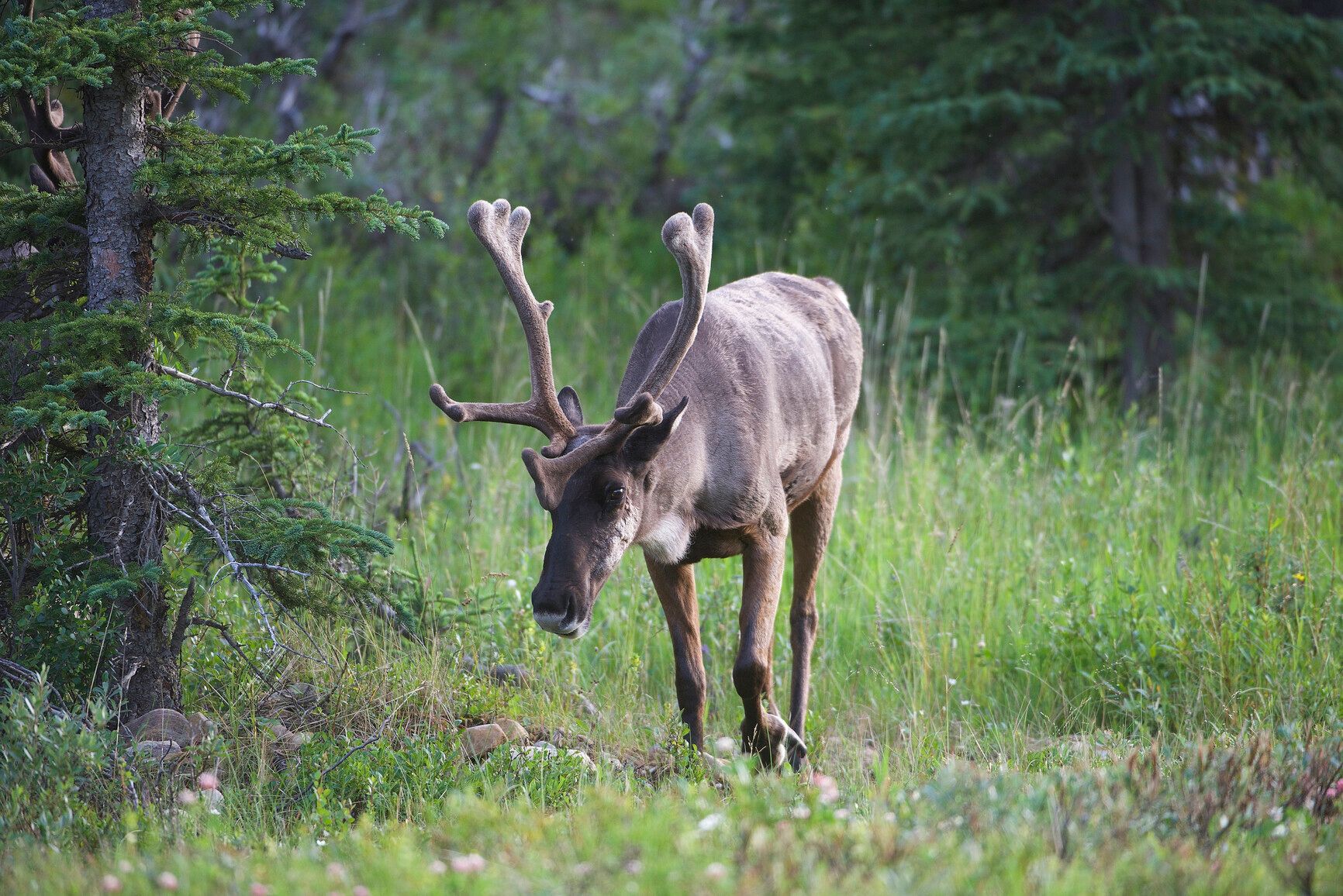
Caribou, stone sheep, and mountain goat winter in the park. You can view caribou and stone sheep along the Alaska Highway. Please reduce speeds and watch for wildlife when travelling on the highway.
Summit and Rocky Crest Lakes are congregation areas for migratory birds. You can view raptors, such as golden eagles, circling the skies. Ptarmigan can often be seen above the treeline.
Stone Mountain Park is home to dangerous wildlife. For more information, see the backcountry safety info, above.
Pets must be leashed and are not allowed in beach areas or park buildings. You are responsible for their behaviour and must dispose of their excrement. Backcountry areas are not suitable for dogs or any pets due to the potential for problems with bears and other wildlife.
Bicycles must keep to roadways and designated trails. Bicycle helmets are mandatory in British Columbia. For information on using bicycles with electric assist motors, see the e-biking section, below.
Bicycles with electric assist motors (e-bikes) are not allowed on the trails within Stone Mountain Park. E-bikes are restricted to park roads and areas where motorized use is permitted.
The only exception is for authorized and identified trail maintenance bikes conducting work on behalf of BC Parks. To get more information on using e-bikes in BC Parks, see the cycling page.
Stone Mountain Park offers opportunities for backcountry horseback riding. This park is only suitable for riders with backcountry experience, as there are no designated trails.
Hunting is only allowed in Stone Mountain Park during open hunting seasons. During hunting season, firearms may be carried by any adult with a valid BC hunting license. All hunters visiting the area should refer to the current BC hunting and trapping regulations synopsis for more information.
There are winter recreation opportunities in Stone Mountain Park. When visiting in winter, always ensure you bring the necessary equipment. For details, please visit the winter safety page.
Stone Mountain Park is at the 595 km mark of the Alaska Highway, roughly 140 km west of Fort Nelson.
Learn more about this park
Park details
- Date established: June 26, 1957
- Size: 25,690 hectares
Park contact
BC Parks contact details
- parkinfo@gov.bc.ca
- 1-800-689-9025 (toll-free from Canada or the US)
- 1-519-858-6161 (international)
Park operator contact details
Stone Mountain Park is operated by Kootenay Forest Services Ltd.
For information about the campground, please contact:
Nature and culture
Conservation
Geology
Stone Mountain Park’s geology is typical of the northern Rocky Mountains’ Eastern Muskwa Ranges. These are characterized by complex folds, wide U-shaped valleys, and rugged peaks of Paleozoic limestone and quartzite.
Compared to the southern Rocky Mountains, the older Muskwa Ranges show evidence of more complex tectonic deformation. Throughout the park, there are examples of tilted sedimentary strata, folds, faults, and synclines.
The park’s topography is steep, with elevations ranging from 1,200 m to 2,500 m. Elevations exceed 2,300 m only in the south of the MacDonald Creek headwaters. At 2,550 m, St. Magnus is the park’s tallest mountain.
Glaciation has been responsible for forming the present-day landscape. The U-shaped MacDonald Valley illustrates this. As glacial ice melted, the area of Summit Lake received immense deposits of gravel and boulders.
This was followed by an intense period of fluvial erosion. As a result, major outwash plains were formed in the headwaters of the North Tetsa River. Five distinct terrace levels indicate the intensity of fluvial action.
Lakes
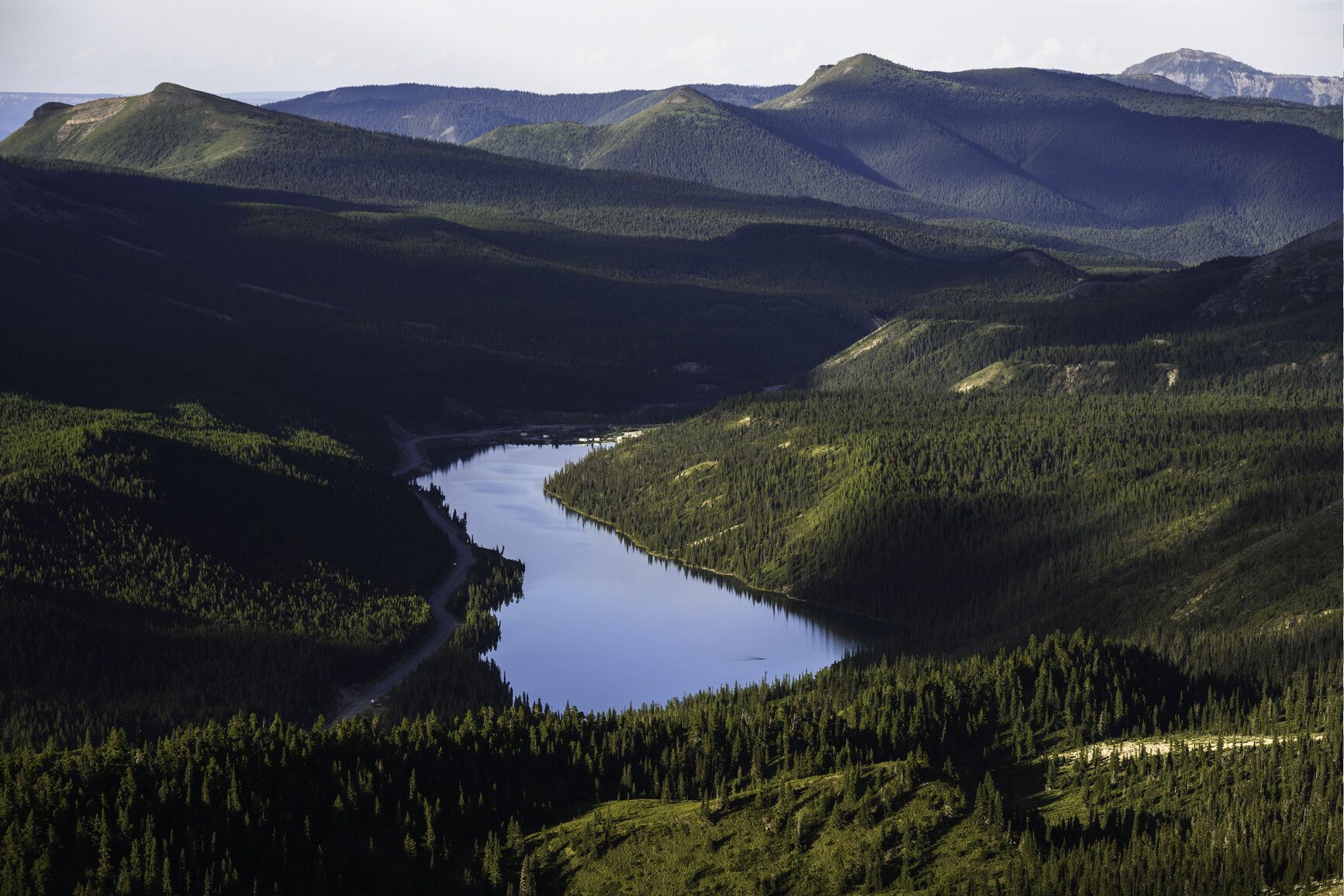
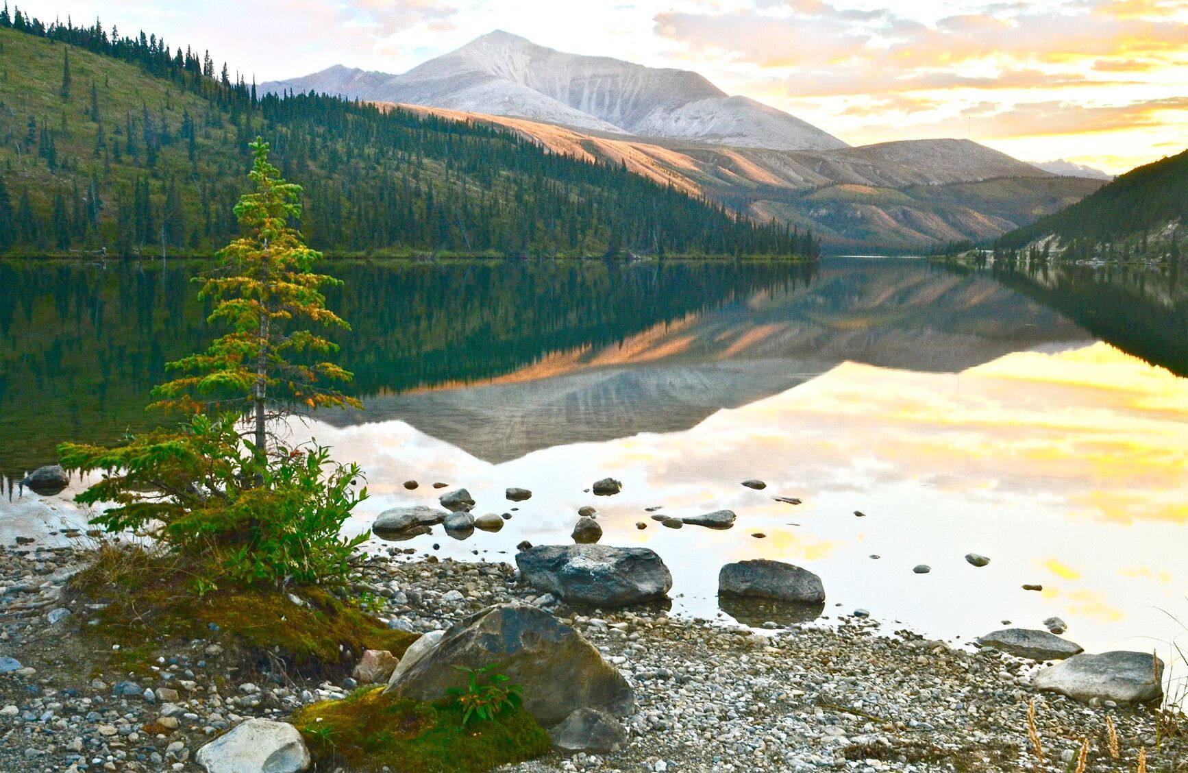
Various water bodies are recharged by meltwater in spring, and rain in summer. Summit Lake is the park’s largest body of water. Rocky Crest Lake, a small sub-alpine lake, lies to the west. Between these two lakes is a broad wetland.
Flora
Due to its mountainous location, Stone Mountain Park supports only two bio-geoclimatic zones. The subalpine zone is characterized by white spruce, willow, birch, and lodgepole pine.
The alpine tundra zone begins above the 1,500 m mark. Scrub birch and willow species are found along wet areas. Grasses and alpine flowers occur in areas that have enough soil to support them.
On shady sites in the alpine tundra zone, small basins of alpine muskeg occur. Please be careful and avoid these soft, spongy areas, as they are very sensitive to trampling and any kind of disturbance.
The park’s alpine meadows offer opportunities to view the Lapland rosebay shrub, which does not grow any further south. This small shrub is from the rhododendron genus and bears showy clusters of bright rose-purple flowers.
Wildlife
Due to Stone Mountain Park’s high elevations and harsh winters, few fur-bearing mammals live here. Squirrel, hoary marmot, and chipmunk are the most common. Less common species include grizzly and black bear, wolf, coyote, lynx, marten, fisher, and beaver. In the summer, mule deer and elk are present.
Caribou, stone sheep, and mountain goat winter in the park. Caribou and stone sheep are visible along the Alaska Highway. Please reduce speeds and watch for wildlife when travelling on the highway.
Migratory birds congregate along Summit and Rocky Crest Lakes. Raptors, such as golden eagles, can be seen circling the skies. Ptarmigan can often be seen above the treeline.
Stone Mountain Park is home to dangerous wildlife. For more information, see the backcountry safety info, above.
Reconciliation with Indigenous Peoples
BC Parks honours Indigenous Peoples’ connection to the land and respects the importance of their diverse teachings, traditions, and practices within these territories. This park webpage may not adequately represent the full history of this park and the connection of Indigenous Peoples to this land. We are working in partnership with Indigenous Peoples to update our websites so that they better reflect the history and cultures of these special places.
