Bringing butterfly habitat to life in BC Parks
Brenda Beckwith, Janice Arndt, and Valeri Huff
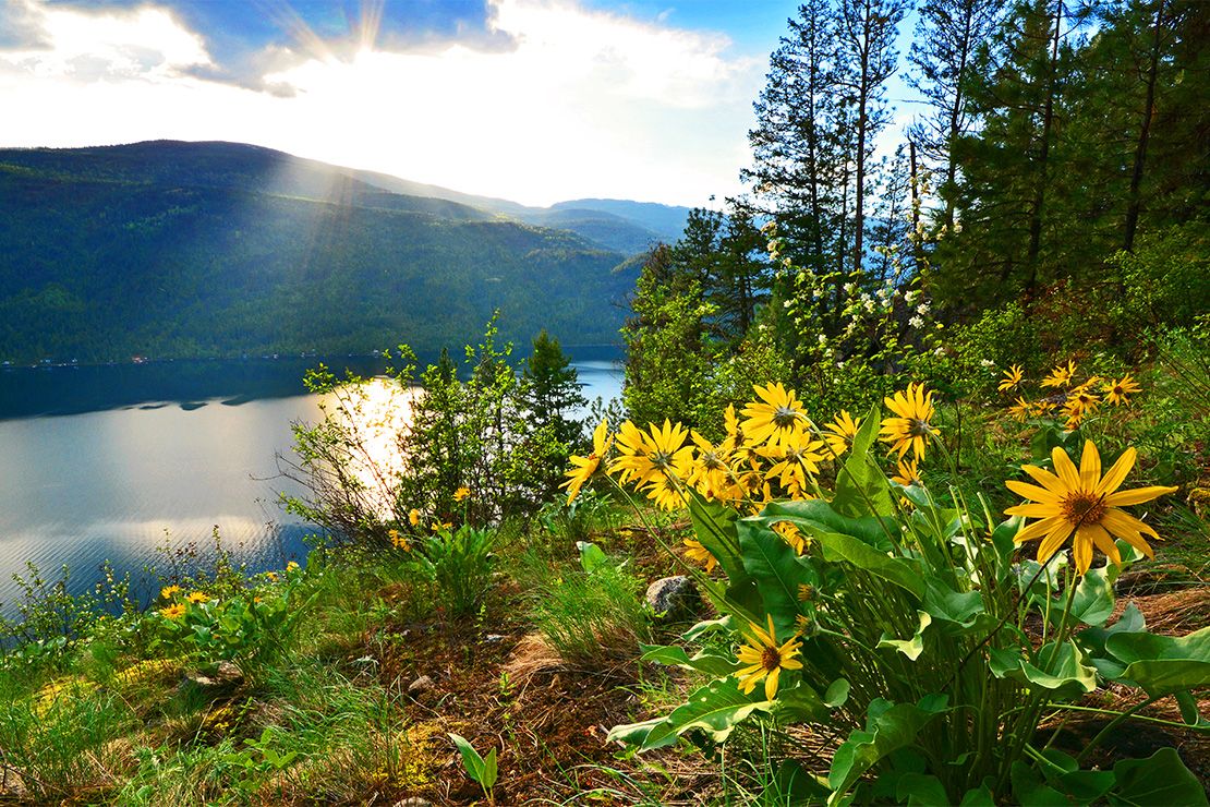
The three-year project, “Building climate resilient butterfly habitat,” represents a partnership among BC Parks, the Kootenay Native Plant Society (KNPS), and Selkirk College. This project is part of the Pollination Pathway Climate Adaptation initiative, a signature program of KNPS. KNPS is an environmental non-profit society based in the West Kootenay region.
Researchers looked at the relationships among native plants and butterflies, especially those butterflies that are rare, or are considered to be vulnerable to changes in climate. The goal is to determine how best to establish meadow habitat that will support butterflies and their food and larva host plants. Research sites were chosen in Syringa and Beaver Creek Parks. These areas are known to support herbaceous plant (non-forested) communities and native pollinators including butterflies, moths, and skippers.
This project has gained several insights that can inform butterfly conservation in West Kootenay. A major finding is that not all butterflies are the same. They are diverse in their behaviours, annual phenologies, and life cycles.
Results from plant surveys show how plant species grow and develop differently based on the environmental conditions of the site. Inadequate water in the soil is especially impactful. Monitoring planted species in the two parks showed that a major limiting factor for plant establishment is soil moisture.
After three years of tracking plant-butterfly connections, researchers have collected 850 records of nectaring, the feeding activity of adult butterflies. This is important because we now have a better idea what plant species are most valuable for food while butterflies are flying.
Waterfall spray zones in Wells Gray Provincial Park: Biodiversity hotspots and potential refugia in a changing climate
Curtis Bjork, Trevor Goward, and Darwyn Coxson (University of Northern British Columbia)
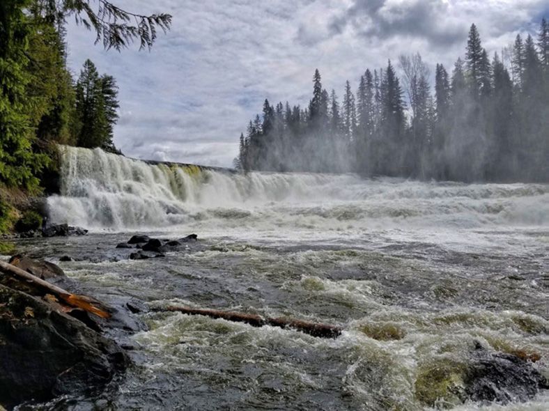
Wells Gray Park is sometimes referred to as “the waterfall park”. One of the major draws for tourism to the park are its waterfalls, most notably Helmcken, Dawson, Moul, and Rainbow Falls. They are visited by tens of thousands of people annually. But Wells Gray’s waterfalls have considerable significance beyond tourism. Researchers are focusing on their dual function as floristic hotspots and vegetational refugia against climate change. This is a line of research that has received limited attention to date. Researchers also assessed the degree to which current visitation has degraded waterfall habitats.
The vertical plunge of large waterfalls creates continuous outflow winds that carry mist and aerosolized nutrients tens or, in some cases, hundreds of meters downstream. The mist has a moderating effect on humidity and temperature, cooler in summer, and warmer in winter. The net result is a unique set of ecological conditions often suited to the establishment of lichens, mosses, hepatics and plants that are otherwise regionally absent or rare. In short, waterfall spray zones are biodiversity hotspots. In principle, spray zones can also be expected to provide a degree of ecosystem resilience against deepening climate change. While other habitats seem set to become increasingly vulnerable to wildfire, drought, heat and wind, the conditions associated with spray zones are more likely to remain stable through time.
Assessment in 2023 found that floristic richness in the spray zones of Are, Dawson, Moul, and Rainbow falls was significantly higher than observed in habitats upstream. Among all spray zones, 866 species were recorded, almost twice as many species (451) as were recorded among all comparison areas. In total, 536 species of hepatics (49), lichens (304), mosses (126), and vascular plants (57) occurred exclusively within spray zones. There were 121 species that occurred only outside of spray zones, 3 hepatics, 49 lichens, 22 mosses, and 47 vascular plants. The spray zone sites collectively supported more than four times as many exclusive species. Climate monitoring at Are Falls confirmed the moderation of summer climate extremes and the longer duration of potential growth periods for cryptogamic plants.
Assessments of biodiversity elements across B.C.’s bog orchid range
Jasmine Janes (Vancouver Island University)
During the summer of 2023, three women embarked on an ambitious project to help document the flora and fauna of some of B.C.’s lesser-visited parks. Dr. Jasmine Janes, from Vancouver Island University, and two undergraduate research assistants, Emma Peterson and Lizzy Schafers, surveyed biodiversity in Duffey Lake, Mount Robson, Crooked River and Stone Mountain Parks. The project was assisted by collaborators at the University of Northern British Columbia, Dr. Dezene Huber and Mackenzie Howse, who provided insect identification.
Researchers made 1,955 observations representing over 200 species of plants, animals, and fungi. Species richness was highest at Stone Mountain, the most northern park visited. Researchers were also able to survey native bog orchid populations. While these orchids are not currently considered at-risk, they are very ecologically sensitive species because of their dependence on both insects and fungi to complete their life cycle. Some of the at-risk species that were encountered include Western toad, stone sheep, woodland caribou, and a subspecies of field loco weed.
Not only does this project provide data for BC Parks, it also provided valuable hands-on training for students. Emma and Lizzy are entering the final years of their Bachelor of Science degrees with a new-found passion for biodiversity, especially botany, and an amazing set of skills. This work provided the opportunity to work in the field, identify species, and use common survey methods, all while seeing some of BC’s amazing landscapes. Experiences like this help to shape the future for the next generation of scientists and resource managers.
These records provide a valuable baseline for the health of our parks against which future management actions can be designed and measured. This project is continuing to work on climatic niche envelope models for the orchid species that were encountered. These models will help predict how sensitive certain species and communities are to climate change. They’ll also help predict where species may move to over time as they track suitable habitat and climates. The BC Parks Living Lab for Climate Change program helps to safeguard these beautiful ecosystems well into the future.
Forest encroachment drivers and dynamics in Churn Creek Protected Area
Jill Harvey (Thompson Rivers University)
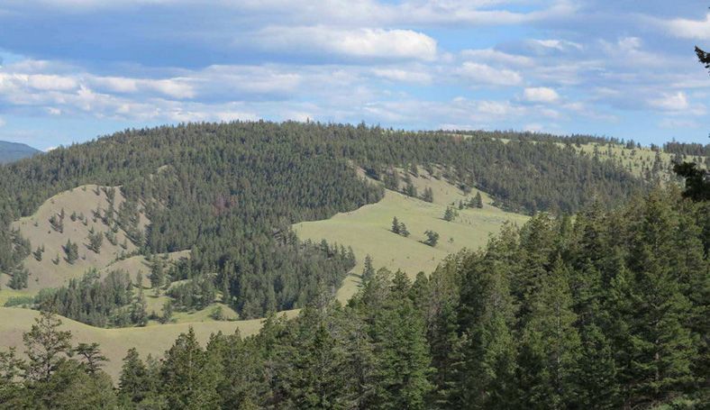
The Churn Creek Protected Area includes some of the largest areas of protected grasslands in B.C. These grasslands and adjacent forests are important ecosystems that support animal habitat, biodiverse plant communities, and culturally important plants. Past research in the protected area relied on tree-rings to record past wildfire events. These studies indicate that wildfire was a frequent visitor in Churn Creek, with fires occurring every 10-20 years and mostly low severity. These frequent fires were ignited by people through Indigenous fire stewardship, and by lightning. Over the past 100 years, there has been very little wildfire in the Churn Creek Protected Area, which has led to forests becoming denser, and the encroachment of trees and other woody vegetation into grasslands.
In July 2021, a wildfire burned a large part of Churn Creek. It burned dense forests at high severity. It’s unclear how forests will recover after this event. In June 2023, together with the Guardians of the Stswecem’c Xget’tem First Nation, researchers established a network of 30 permanent sampling plots in areas affected by low, moderate, and high severity fire. They measured the regeneration of vegetation three years following the 2021 fire. Preliminary results suggest that areas affected by low and moderate severity wildfire have more species present and overall plant cover than areas affected by high-severity wildfire. Further research to assess fire severity effects on invasive species, species diversity, and culturally important plants is ongoing. The network of permanent sampling plots will be expanded in summer 2024 and then revisited every three years to gain a better understanding of how these forests regenerate after high-severity wildfire.
In 2005 and 2006, BC Parks conducted a trial at the Dry Farms area to remove fuel in the encroached grassland-forest ecotone areas. They did this by thinning the forests and then applying a prescribed burn. The study was designed to see how treatments have affected grassland communities and the resilience of trees to drought. Using vegetation surveys and tree-ring approaches, researchers hope to be able to provide recommendations on the further application of these treatments in the protected area.
At another location in the protected area, researchers sought to better understand the drivers behind tree encroachment in ecotone forests and grasslands, besides the general absence of fire over the past approximately 100 years. They cored, or took base sections, from about approximately 1500 trees. Using one-hectare plots, they sampled every tree to see what factors (for example, climate or grazing) are associated with the establishment of trees in these settings. This research will help determine how climate and landscape uses impact forest change over the past 100 years, with insights on what to expect in the future.
Understanding above- and below-ground alpine plant responses to climate change and increasing recreational traffic in the coastal mountains of British Columbia using observational and experimental methods
Cassandra Elphinstone, Courtney Collins, Ciara, Sebastian, Emma, Teagan, Annabelle, Aino, Natalie Krause, Nathalie Chardon, Philippa Stone, Noémie Boulanger-Lapointe, Greg Henry, and Nina Hewitt
For the past two summers (2022-23) researchers from the University of British Columbia studied the impacts of climate change and recreation on subalpine plant communities in the Nch'kay mountain region of Garibaldi Provincial Park. This project had several themes.
Warming experiment
To understand the effects of warming on tundra plants, researchers installed twelve open top warming chambers to passively warm (1-3 ºC) plots (1 m x 1 m) at both Sphinx and Sentinel Bays on the far side of Garibaldi Lake. They followed standard protocols of the International Tundra Experiment (ITEX), a network of researchers examining the impacts of climate change on tundra ecosystems. The team set up climate data loggers at plots to record air and soil temperatures, and soil moisture, and installed time lapse cameras (phenocams) to record imagery every 30 minutes during summer to indicate greenness and flowering times across warming and control plots. To study below ground changes, researchers buried mesh tubes of sterilized soil, and later removed them to measure root growth into the cores and how this changed with warming. They then tested for changes in soil microbial (fungi and bacteria) growth caused by the warming experiments.
Trampling study
To understand the effects of human trampling on alpine plants, researchers set up permanent 0.5 m x 10 m trail-side and off-trail transects near t'ak't'ak mu'yin tl'a in7in'a'xe7en (Taylor Meadows, Black Tusk, and Panorama Ridge trails). In 2022, they quantified the effects of trampling disturbance on plant size and reproduction of dominant species and found that blueberry plants’ size and reproduction is more impacted than heather species and sedges. In 2023, they returned and found evidence of differences in species community composition between the trampled and untrampled plots and continue to explore these data.
Aerial imagery
Planet satellite imagery and drone footage of Sphinx and Sentinel bays were collected in 2023. Pixels were classified based on colours (spectral profiles) to determine the locations of different plant communities in the imagery. To assess the accuracy of the pixel classification, researchers surveyed the plant communities across both bays at 40 haphazardly selected waypoints in the field.
This research will help determine how accurately aerial imagery at different scales can predict vegetation composition. In the future this could be used across the park to predict where vulnerable versus resilient species are found and thus where infrastructure and trails could be located.
Sḵwx̱wú7mesh Nation
To better understand the interests and priorities of the Sḵwx̱wú7mesh Nation with regards to our project, researchers held virtual meetings with members of the Nation’s Rights and Title, Language and Cultural Affairs Department in 2022.
Through these meetings, the team became aware of issues the Nation is facing regarding park access and developed a map this summer (2023) of the locations with limited access and culturally important plants to highlight regions that could use specific attention.
Virtual Reality Experiences
Researchers created visual immersive storytelling experiences of the field work at Taylor meadows, Sphinx and Sentinel Bays to allow the public access to view the research sites and share the findings and the landscapes involved in an open, accessible format.
Finding the vulnerabilities of low-elevation Forest systems on Vancouver Island amidst a changing climate
Pam Shaw (Vancouver Island University), Kyla Seward, Graham Sakaki, Jessica Pyett, and Heather Klassen
Each year, the Mount Arrowsmith Biosphere Region Research Institute (MABRRI) goes through the cycle of examining each phenophase that defines the important moments of a plant’s life. Some of those phases include bud break, leaf out, flowering, pollen, fruit, seed drop and falling leaves. Red huckleberry strains for light and gradually flushes out to a full canopy ripe with berries. The new leaves of salal bushes turn dark green to prepare for the upcoming cold.
Since 2017, MABRRI has been working to establish a baseline for study species responses to climate and climate-related triggers that may induce or impact each phenophase. Selected for their presence across low elevation forest systems on southern Vancouver Island, the study species include red huckleberry, western hemlock and salal. With the addition of two sites in BC Parks in 2020, there are now six study sites, spanning across two biogeoclimatic units. While these study sites represent average soil moisture and average climatic conditions for minimal variance between sites, one can still revel at the intricacies of each unique forest system and the trends we see year to year on plant development. With each year of collected data, researchers gain a broader picture of the vulnerabilities within coastal plant communities.
To identify these vulnerabilities, each site is equipped with an array of timelapse cameras arranged around a central microclimate station. Stations are armed to detect wind, temperature, precipitation, relative humidity, soil moisture and soil temperature.
Compiling years of microclimate data for thorough analyses will give an understanding of how plants in low elevation systems are currently responding to climate. In turn, this will allow for use of predictive modeling to assess how plant communities in these systems may change in either distribution, composition or simply the way they express phenophases with different climate change scenarios.
Temperature has long been the focus of these kinds of studies, and though it plays an important role in this study, the researchers are looking forward to diving into the other climatic variables that could have an effect on when and how phenophases are expressed.
With drought conditions becoming more frequent on southern Vancouver Island, researchers are eager to see the role soil moisture plays in plant development in these low elevation forest systems. As each season draws to a close and they have the opportunity to compile the data, they find themselves very much in an investigative role. They are looking for clues, figuring out the right questions to ask and feeling grateful for the opportunity to discover important connections that could help prepare for a changing environment.