Contents
- Reconstructing historic fire activity and whitebark pine distributions in Tweedsmuir Provincial Park
- Pollinator conservation management for climate change in British Columbia
- The BC Parks iNaturalist Project: biodiversity across the BC Parks system
- BC Parks West Coast Region Climate Change Vulnerability Assessment
- Coastal Plant Phenology Research and Monitoring Project
- Kokanee Glacier Forecast Project
- Characterizing changing winter snow conditions at high-use B.C. recreational provincial parks
- Building climate-resilient butterfly habitat
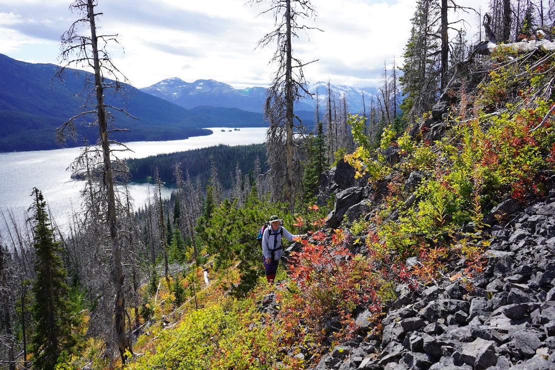
Reconstructing historic fire activity and whitebark pine distributions in Tweedsmuir Provincial Park
Dr. Lori Daniels, Dr. Kira Hoffman, and Dr. Alana Clason, UBC
Researchers completed the first fire history reconstruction in Tweedsmuir Provincial Park in collaboration with BC Parks, the University of British Columbia, and the Bulkley Valley Research Centre with support from the Cheslatta Carrier First Nation. Twenty-five fire events were reconstructed over 250 years (1711-1957) and created an 850-year fire history chronology across 11 sites in North Tweedsmuir Park using fire-scarred whitebark pine trees. Multiple lines of evidence suggest that prior to a century of fire exclusion of both lightning and cultural fires, low-severity fires occurred regularly across the study area (on average every 10 years). These fires were likely a component of millennia of Indigenous fire stewardship. Over 500 million hectares of forest in Tweedsmuir Park burned under severe fire weather conditions in the 2017 and 2018 wildfire seasons, but these severe wildfire events represent a significant departure from the historic fire regime. Supporting Indigenous-led fire stewardship and the reintroduction of low and mixed-severity fire to lower elevation subalpine forests may create forest and fuel conditions that could protect these ecosystems from increasingly severe wildfire events under a rapidly changing climate, as well as providing regeneration habitat for whitebark pine.
Pollinator conservation management for climate change in British Columbia
Leithen K. M’Gonigle & Sarah A. Johnson, SFU
Forests are important but understudied habitats for bees and bumble bees, critical pollinators in the temperate forested regions that are protected by many of British Columbia’s provincial parks. As climate change accelerates, the historical forest fire regime experienced across the province is changing rapidly. Some changes in forest fire behaviour in parks (for example, intensity, size) may necessitate changes in forest fire management in parks (for example, front country vs. backcountry suppression). Given that pollinators are foundational for habitat regeneration following fires, this project quantified how communities of these important pollinators respond to fire-induced habitat changes on multiple scales, and whether community structure and foraging movement varies in front country vs. backcountry management zones in Tweedsmuir Provincial Park. Researchers found that Tweedsmuir Provincial Park is a key location for the study of bumble bee community responses to changing forest fire conditions in remote protected areas, given the exceptional number of bumble bee species present (14+ species), fire activity (60+ fires over the past 15-20 years), and its potential as a reservoir for declining species (Bombus terricola, Bombus occidentalis).
The BC Parks iNaturalist Project: biodiversity across the BC Parks system
Brian Starzomski, UVIC and John Reynolds, SFU
The BC Parks iNaturalist Project uses the iNaturalist citizen-science platform to collect observations of species in all protected areas around the province. Each provincial park, conservancy, protected area, and ecological reserve has its own collection project, and any park visitor can contribute their observations to the project, using a phone or other camera to take photos of species encountered.
Visit the BC Parks iNaturalist Project website
In the project’s third year, teams documented more than 178,000 new observations showcasing B.C.’s incredible biodiversity in 135 provincial protected areas. Field teams located several rare species and invasive species too. A species of springtail (tiny, wingless insects with a hump-backed appearance) was discovered that is new to science, (Sminthurinus sp.) along with a recently discovered but still undescribed species in the treehopper family (Enchenopa sp.).
In addition to gathering baseline biodiversity data, project teams conducted 21 webinars and met with BC Parks staff, ecological reserve wardens, and ecologists in the field in 2021. Understanding the biodiversity in protected areas is key to informed management decisions in our changing climate.
BC Parks West Coast Region Climate Change Vulnerability Assessment
Hayley Datoo, Catherine Jacobsen, BC Parks and Erica Crawford, Shift Collaborative
Managers in BC Parks West Coast Region are increasingly faced with management issues and decision-making in response to impacts on park values from climate-related risks. In recent years, parks and protected areas have experienced repeated impacts from storms, extreme river flows, flooding, wildfire, erosion and shifting species and ecosystems. These changes affect a wide range of biodiversity, cultural and recreational values, along with park operations and facilities. This project was initiated to pilot the Canadian Parks Council’s Climate Change Adaptation Framework for Parks and Protected Areas to examine relevant climate change impacts, assess risk and describe vulnerabilities in the West Coast protected areas system. Through a participatory process involving BC Parks staff along with First Nation partners from the Ka:'yu:'k't'h'/Che:k:tles7et'h' First Nations and informed by a synthesis of climate data for the region, participants identified key vulnerabilities and a range of systemic and on-the-ground strategy options to begin meeting the challenges. This project provided a starting place to consider the impacts of climate change and integrate this information into planning and decision-making for parks and protected areas in BC.
Coastal Plant Phenology Research and Monitoring Project
Pam Shaw, VIU and Jessica Pyett, Mount Arrowsmith Biosphere Region Research Institute
The Coastal Plant Phenology Research and Monitoring Project was initiated to evaluate the vulnerability of plant species and ecosystems to climate change on Vancouver Island. Studying plant phenology, the timing of cyclic biological changes, and the relationships between climate and phenological development builds our understanding of how individual species and ecosystems respond to climate now.
In 2021, the field cameras were deployed again in early March to capture a second full year of data. Two Vancouver Island University students were hired to interpret plant phenology observations from the field camera photos, as well as quality check the microclimate data. The research team also completed a preliminary microclimate data and red huckleberry leaf onset and fall phenology comparison between the existing research sites and the new BC Parks sites. The team identified some interesting trends between and across all the sites, including the onset of fall phenology much earlier than previous years. This could be one of the impacts of the heat dome that was experienced across BC this summer. Recent extreme weather events reinforce the importance of monitoring plant phenology and microclimate to ensure we capture the response of plants and to understand how plants may respond to projected warmer, drier conditions.
Kokanee Glacier Forecast Project
Brian Menounos and Ben Pelto, University of Northern British Columbia
Climate change has meant that glaciers worldwide are losing mass and retreating at a measurable pace. Since 2004, the Kokanee Glacier has retreated more than 500 metres, averaging 30 metres per year. The fate of this and other glaciers can be predicted by modeling the current balance of snow accumulation vs ice melt on an annual basis and using climate change models to inform estimates of future mass balance. Glacier measurements are taken using airborne light detection and ranging (LiDAR), as well as on-the-ground measurements of snow depth and density.
The ongoing melt of the Kokanee Glacier poses risks to visitors who wish to travel across it and has implications for the ecology of the entire watershed. In 2021, the Kokanee Glacier lost over two metres of thickness, which is three times the average annual loss. Modelling work indicates that the glacier could completely disappear between 2050 and 2080, depending on which emissions scenario eventuates.
Characterizing changing winter snow conditions at high-use BC recreational provincial parks
Nicholas Coops and Brianne Boufford, Integrated Remote Sensing Studio, UBC Forestry
Many BC Parks have significant amounts of snow cover that affect recreational usage, hydrology, and biodiversity. In this study, eight parks were examined to determine trends in snow-pack dynamics over the past two decades (2000-2020). These parks were Callaghan Lake Park, Callaghan Conservancy, Cypress Mountain, Manning Park, Garibaldi Park, Mount Seymour Park, Pinecone Burke Park, and Upper Soo Conservancy. Remote sensing data from satellites (Landsat and MODIS) allows the calculation of daily snow cover at a resolution of 30m x 30m, and the determination of annual snow accumulation, snow melt, and the number of days with snow cover per year. Although there was variation over the past 20 years, overall there has been a decrease in snow coverage in all of the eight monitored parks. For example, in a good snow year, Mount Seymour saw as much as 34% more snow than average, while in a bad snow year, there was about 24% less snow than average. Across all parks and all years, the decreases in snow cover in bad snow years outweighed the increases in good snow years. On average, there have been eight fewer days with snow in the past five years compared to the first five years of this time period, and the date of snow melt is about eight days earlier.
Building climate-resilient butterfly habitat
Brenda Beckwith, Janice Arndt, Valerie Huff, Selkirk College
This multi-year study aims to characterize the butterfly and plant diversity within Beaver Creek and Syringa Provincial Parks and monitor the status of at-risk butterfly populations and their potential vulnerability to climate change. The first year of the study established a baseline of plant and butterfly diversity and richness, and made observations of butterfly-plant associations. Observations of plants showed that peak flowering occurred during June and July. Several non-native plant species were present at Beaver Creek, perhaps due to its popularity as a hiking and dog-walking location. Overall, 32% of all plant species recorded in the research sites were non-native. Non-native species are still important to provide food for butterfly species, however, and are not currently a management concern for invasiveness. Native plant species were seeded at Syringa, and preparations for interpretive signage were made. Both Syringa and Beaver Creek have a high diversity of butterfly and plant species. In 2022, this research will continue with the establishment of restoration plots and developing a list of recommendations for species to plant to support butterfly populations.