Skeena East.
Know before you go
Advisories
Safety information
Wilderness safety
The backcountry of Tweedsmuir Park is an isolated wilderness with infrequent patrols by park staff. You should be experienced in wilderness travel, fit and well equipped. If you plan to hike overnight or longer you should inform a responsible person or agency of your intentions, including estimated return time and destination. As in any wilderness setting, be prepared to be self-sufficient. For those new to the wilderness adventure tour, guides are available in the area.
Weather
Weather conditions in the park are as variable as the topography. Moderate temperatures and extensive rainfall characterize the lower reaches of the Bella Coola Valley. At Stuie near the junction of the Atnarko and Bella Coola Rivers, there is an average annual precipitation of 720 mm with about 20 percent of this being snow. The interior plateau receives a greater proportion of snow and is possible any month of the year, though winters are more severe. Temperatures in the southern section of the park can drop to -40°C in January and reach 30°C in July. Summers are usually fairly dry with June, September and October being the wettest months.
Bear safety
Grizzly and black bears range throughout the park. Gizzlies congregate on the Dean, Atnarko, and Bella Coola Rivers between May and October when salmon are in the river. People should be particularly cautious when fishing, hiking, and camping. Please read the BC Parks wildlife safety information. Hunlen Falls/Turner Lake Trail - Hikers traveling along the 4x4 road must not camp along the road, at the parking lot, or at Stillwater Lake. The road and the first three kilometres of the trail should be hiked between late morning and early afternoon, when bears are the least active.
Trail information
Trails in the southern portion of Tweedsmuir Park are not being regularly maintained. Please be aware that you may encounter fallen trees and trail wash outs. Extra caution is advised. Also, it is important to note that Rainbow Range trails are used by both horse users and hikers. Please respect each other’s use. More information on trails in the area can be viewed on the trail Information page.
Special notes
Commercial recreation opportunities are available for the Turner Lake Chain (canoe rentals) and in and around the Atnarko River. Please contact us for more information.
There are tourist facilities and supplies at Bella Coola, Hagensborg, Nimpo Lake and Anahim Lake.
Review the detailed guides under visit responsibly for more information on staying safe and preserving our natural spaces.
Visit responsibly
Follow these guides to ensure your activities are safe, respectful, and ecologically friendly:
Maps and location
- Park area map [PDF] (July 2008)
- Park map – Hunlen Falls/Turner Lake Chain area [PDF]
- Park map – Rainbow Range area [PDF]
- Snowmobile map [PDF]
- Park brochure [PDF]
- Rainbow Range brochure [PDF]
- Hunlen Falls/Turner Lake Chain brochure [PDF]
- Atnarko Campground [PDF]
- Fisheries Pool Campground [PDF]
- Map of the snowmobiling area [PDF]
Open KMZ and KML files with Google Earth or a similar navigation application.
Getting there
The southern portion of Tweedsmuir Provincial Park is located on Highway 20, approximately 400 km west of Williams Lake, between Anahim Lake and Bella Coola. The highway from Williams Lake consists of both gravel and paved sections. You can obtain fuel, basic supplies, and motel accommodation in Anahim Lake or Nimpo Lake. The nearest RCMP office is in Anahim Lake, where there is also a 24-hour medical clinic. The closest hospital is in Bella Coola, over an hour’s drive from the parking lot.
The "Hill" is the stretch of Highway 20 between Heckman Pass and Atnarko campground. It has quite a reputation since it loses over 1200 m in elevation within 16 km. Though steep (up to 18 percent grades), it is passable throughout the year.
The park can also be reached by way of the Discovery Coast Passage ferry from Port Hardy on Vancouver Island, by float plane from Nimpo Lake, Anahim Lake, or Bella Coola, or by hiking in the backcountry.
Tote Road provides access to the Hotnarko parking area, and is a four-by-four high clearance vehicle only road. Expect rocks, ditches and brushed-in conditions.
Topographic Maps
National Topographic Series Maps 92N/13, 93C/4, 93/5, 93C/12 and 13, 93D/8E and W and 93D/9 and 16 at a scale of 1:50,000 cover the Tweedsmuir area.
Things to do
For your own safety and the preservation of the park, obey posted signs and keep to designated trails. Shortcutting trails destroys plant life and soil structure.
Please view the trail information page for more information on the various trails of this park.
Swimming is not recommended in the Bella Coola and Atnarko Rivers at the campgrounds. The alpine and subalpine lakes you encounter in the backcountry are delightful for swimming, especially from the white sand beaches of the Turner Lake Canoe Chain.
There are no lifeguards on duty in BC Parks.
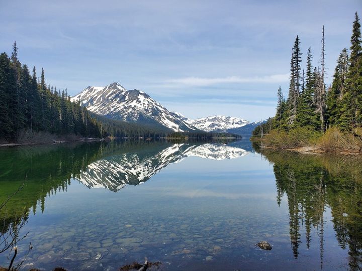
The Turner Lake Canoe Circuit is a three to five day canoe trip through spectacular mountain scenery located south of Highway 20. The canoe chain comprises approximately 18 km of lakes and 2.5 km of rivers and creeks. The portages are short, with the longest being 1 km. The gate to the Turner Lake Chain is open from June 15 to September 15.
The chain can be accessed via float plane from Nimpo Lake or by exiting Highway 20 onto Tote Road (12 km to trailhead), then by hiking for 16 km along the Hunlen Falls Trail.
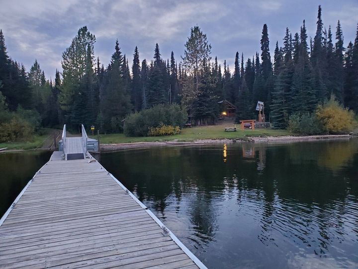
Canoe rentals and a campsite are available at Turner Lake. A fee is charged for camping. For more information on canoe rentals and access to the Turner Lake Chain, please contact us.
There are extensive fishing opportunities at this park. Pink, chinook, and coho salmon, as well as char, trout, and white fish are caught in the Bella Coola and Atnarko Rivers. The Dean River is renowned for its fly fishing.
The backcountry lakes and rivers provide some excellent sport fishing for coastal cutthroat along the Turner Lake Canoe Circuit. The lakes of the area can be fished for Dolly Varden, cutthroat and rainbow trout.
There is a trailhead just before you reach the Fisheries Pool campground. This 1 km trail leads to a popular fishing hole, but take great caution as it is also very popular with bears.
Do not cut or lay fish on picnic tables. Bleed and clean all fish in the river and throw offal into fast flowing water. Handle roe cleanly. Store fish and bait in a sealed container in your vehicle.
Anyone fishing in British Columbia must have an appropriate licence. To learn more, see the fishing and hunting guide.
The Atnarko Corridor and Highway 20 has a healthy population of both grizzly and black bears. Grizzlies congregate on the Dean, Atnarko, and Bella Coola Rivers between May and October when salmon are in the river.
The Belarko Wildlife Viewing Area is collaboratively managed by BC Parks and the Nuxalk Nation. Using this area reduces the risk of potential injury to park visitors from bear encounters and leave sections along the river where bears can feed undisturbed by humans.
- Peak wildlife viewing season is September 1 to October 30, which is also a critical feeding time for bears in their natural environment.
- Visitors are strongly encouraged to view bears in their natural environment from the Belarko Wildlife Viewing Area to respect bears during this time, and for public safety.
- Belarko Wildlife Viewing Area is located on Highway 20, 13 km inside the west boundary of the park, adjacent to the Belarko Boat Launch and 3 km past Fishers Pool Campground. The viewing area is surrounded by an electric fence supported by a cedar-rail fence. Qualified staff are present in the reception and viewing areas to enhance public safety and provide information on viewing protocol, cultural significance of the area, and other recreational opportunities within Tweedsmuir Park. Individuals are responsible for their own safety while at the viewing area.
- Belarko Wildlife Viewing Area is open from September 1 – September 30
- September 1-20: OPEN DAILY 7:00 am to 7:00 pm
- September 21-30: OPEN DAILY 8:00 am to 6:00 pm
- There is no charge to visit the viewing area, however, there is a donation box to help support the bear viewing program and conservation of bears in the Atnarko Corridor.
- Fisheries Pool Campground and day-use area is a multi-use area. Bear viewing in Fisheries Pool is not encouraged, and visitors are doing so at their own risk. All park users recreating within Fisheries Pool Campground must follow all direction given to them by BC Parks rangers.
- Park visitors wanting to participate in land based or water based viewing activities must do so with a commercial operator with a valid Park Use Permit.
- Park visitors wanting to drift the Atnarko River from the Belarko boat launch must check in with Nuxalk and BC Park ranger staff at the Belarko Wildlife Viewing Area.
- For further information on bear viewing edict within Tweedsmuir Park (South) please watch the following information video Bear Viewing Research - YouTube
Please be aware of the closure areas from September 1 to October 15 only:
- Esker Trail from Stuix to Fisheries Pool Campground (this includes all areas upstream of the fish counting station and sunset bluffs)
- The Smoke Hole which is a access area to the Atnarko River located in Stuix
- Belarko boat launch is closed to all recreation activities except for non-motorized boat use
- Atnarko Campground and the old Atnarko Ranger Station yard are closed to the public
If you must bring your pets into the backcountry, they must be kept under control at all times. Backcountry areas are not suitable for dogs or other pets due to the potential for problems with bears and other wildlife.
Bicycles must keep to roadways. Bicycle helmets are mandatory in British Columbia.
Please note that bicycles with electric assist motors (e-bikes) are not allowed on the trails within Tweedsmuir Park (South). E-bikes are restricted to park roads and areas where motorized use is permitted. The only exception to this policy will be for authorized and identified trail maintenance bikes conducting work on behalf of BC Parks.
The discharge and carrying of firearms is permitted in this park for the purposes of hunting during open season. Please consult the BC Government Hunting and Trapping Regulations Synopsis for more information. Contact BC Parks at parkinfo@gov.bc.ca with any specific questions.
Anyone hunting in British Columbia must comply with BC hunting regulations. To learn more, see the fishing and hunting guide.
Skiing
There are downhill skiing opportunities in this park. A tow rope is operated by the Tweedsmuir Ski Club on Sundays during the winter. It is located 3 km from the parking lot at the Rainbow Range trailhead.
There are approximately 15 km of set cross country skiing trails at the Rainbow Range trailhead during the winter. These are maintained by the Tweedsmuir Ski Club.
Snowmobiling
An area is zoned for snowmobiling at Heckman Pass. Snowmobiling is not permitted elsewhere in the park. The snowmobile area is accessed through the Rainbow Range trailhead, about 40 km west of Anahim Lake on Highway 20.
For maps of the snowmobiling area, see the maps and location section
The Rainbow Range is the winter home of a large herd of woodland caribou and mountain goats. Both these populations are considered threatened, and animals are easily disturbed by recreationists.
In winter, caribou favour open windward slopes where snow is thin and they can access their staple food, ground lichens. However, caribou will sometimes use deep snow for lift to reach lichens hanging from tree branches. Mountain goats also eat exposed vegetation, and tend to stay near the steep rocky terrain they use for an escape route. They can become particularly stressed when approached from above.
If you go, please read and observe the following:
- Stay within the snowmobile boundary shown on the map. This area is regularly patrolled by BC parks staff.
- Use only the designated snowmobile trail to access the overnight cabin, ski hill, and snowmobile area.
- Carry out all your garbage.
- Stay clear of ski trails.
- Never run your machine over areas bare of snow, as this can destroy the lichens on which the caribou depend.
- Avoid snowmobiling over exposed tree tops.
Use the following procedures around wildlife:
- If you observe caribou or goat tracks, do not follow the tracks.
- If you see caribou or goats, do not approach them. Turn off your snowmobile and allow the animals to move away quietly.
- After animals have departed, leave the area. Make every effort to minimize disturbance.
- Chasing wildlife on a snowmobile can be fatal for the animals, who often die of exhaustion after struggling through deep snow.
Safety
Anywhere there is snow lying on a slope, there is the possibility of an avalanche. These snow torrents are deadly and deserve the utmost respect. Take an avalanche safety course and be aware of weather forecasts and snow conditions. For more avalanche information, contact the Canadian Avalanche Association. Each person should carry rescue gear: shovel, probe, and avalanche rescue beacon.
Suffocation is a common cause of death after being buried by an avalanche. It is crucial to find the victim within minutes. The use of beacons greatly increases the likelihood of survival. Probe and shovel are necessary because avalanche debris sets up like concrete, making digging very strenuous.
The Rainbow Range is very remote and is subject to sever winter weather. Snowmobilers should prepare for emergencies such as breakdowns and injuries by carrying tools, spare parts, extra gas and oil, a first aid kit and survival gear including a portable stove.
Facilities
The Tweedsmuir Ski Club operates a cabin close to the downhill ski area. Overnight stays can be reserved by calling the club at (250)-982-2231. The Rainbow Cabin, located in the Mackenzie Valley, is for emergency use only. Free winter camping is permitted in the Rainbow Range parking lot. There is an outhouse, but you must either bring your own drinking water or melt snow.
Map
1:50,000 NTS topographic maps include: 93C/12
About this park
The park and surrounding areas have been used by the Nuxalk and Carrier First Nations for thousands of years. Routes known as “grease trails” enabled the interior peoples to trade furs and obsidian for marine products such as eulachon grease. The Nuxalk people of the Bella Coola valley depended on the abundance of salmon in the rivers for their livelihood. Today, descendants of these earliest inhabitants catch and process fish from the same rivers in much the same way as did their ancestors. If you come across any First Nations heritage sites, do not disturb them or remove artifacts.
Signs showing information about the Nuxalk and Ulkatcho First Nations, are proudly displayed in Tweedsmuir Park and were developed collaboratively between Nuxalk and BC Parks.
Tweedsmuir Park is one of the largest in British Columbia. In the west-central region of the province, this triangular shaped park can be found 480 km northwest of Vancouver. It is bounded on the north and northwest by the Ootsa-Whitesail Lakes reservoir, on the west and southwest by the Coast Mountains, and on the east by the Interior Plateau.
The park was established in 1938. It is named for the 15th Governor General of Canada, John Buchan, who bore the title Baron Tweedsmuir of Elsfield (and enjoyed a successful side career as a writer of thrillers, such as The Thirty Nine Steps). The Governor General travelled extensively by float aircraft and horseback in the park in August of 1937, and he and his party were greatly impressed by its magnificence. In a booklet issued to commemorate his visit he stated in the foreword:
"I have now travelled over most of Canada and have seen many wonderful things, but I have seen nothing more beautiful and more wonderful than the great park which British Columbia has done me the honour to call by my name."
Alexander Mackenzie travelled through the area of the park on his epic journey to the Pacific Ocean in 1793. Mackenzie was the first white man to view the western seas from the shores of northwest America, ahead of the more widely known Lewis and Clark expedition by more than 12 years. Mackenzie and his party trekked overland from the Fraser River, across the Interior Plateau, through the Rainbow Mountains and down Burnt Bridge Creek.
Where the creek enters the Bella Coola River, they rested at a community they dubbed “Friendly Village” because of the hospitality of its Nuxalk inhabitants. These people guided Mackenzie and his men down the river into Dean Channel. A dispute between the Nuxalk and the coastal Heiltsuk people prevented them from reaching the open sea, but Mackenzie was satisfied that his mission was complete. In his journals he wrote:
“I now mixed up some vermilion in melted grease, and inscribed in large characters on the face of the rock on which we slept last night, this brief memorial, Alexander Mackenzie, from Canada, by land, the twenty-second of July, one thousand, seven hundred and ninety-three."
Mackenzie's rock, on the north shore of Dean Channel, is marked with a cairn and preserved in Sir Alexander Mackenzie Park.
Lonesome Lake, in the southeast part of the park, has become well-known through the publication of books and stories about Ralph Edwards, who settled at the lake not long after the turn of the century and many years before the park was created. The struggle of Edwards and his family to wrest a homestead from this harsh wilderness has made their story a classic of Canadian pioneering spirit.
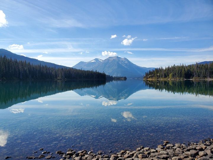
The topography of the area is extremely varied. East of the park near Anahim Lake, the Interior Plateau abruptly gives way, at an elevation of about 1,350 metres, to peaks of the Rainbow Range. The range, Tsitsutl, meaning 'painted mountains' in the local dialect, is an enormous dome of eroded lava and fragmented rock that presents to the viewer an astonishing spectrum of reds, oranges, yellows and lavenders.
Contrasting with the vivid colouration and gentler slopes of the Rainbow Range are the higher and more rugged Coast Mountains that mark the western extremity of the park. Vast glaciers sculptured these granite giants, leaving behind serrated peaks still under the erosive attack of alpine ice. Tzeetsaytsul Peak - so named by the local Indigenous people for the rumble and boom of its glacier - and its neighbour, Thunder Mountain, are dominant features of the park’s western boundary.
Monarch Mountain, in the southwest corner of the park, is, at 3,533 metres, the highest mountain in the area. Further evidence of the glacial activity of the past along the park’s west side are the deep valleys of the Bella Coola and Atnarko Rivers and ocean fjords like Dean Channel.
The climate and topography influence the type and distribution of vegetation, with four zones being easily identifiable. Commencing at the coast and extending inland along the Talchako and Dean Rivers is a coastal hemlock forest that thrives in this moist area. Farther into the park the climate is drier since much precipitation has been shed by the time Pacific air masses have passed through the mountains.
At lower levels and on the plateau, forest cover is a combination of Douglas-fir and trembling aspen or lodgepole pine interspersed with natural meadows. High on the mountainsides is dense Englemann spruce and sub-alpine fir growth that gives way above 1,650 metres to treeless alpine tundra.
Flowers, trees and shrubs are part of the park’s natural heritage, please don’t damage or remove them.
Most large mammals are wide ranging and difficult for the casual visitor to spot. The alpine and grass meadows north of Highway 20 are the habitat of grizzly bears, black bears, mountain goats, caribou and wolves and the summer range of moose and mule deer. In the summer and into the late fall grizzly bears utilize the Atnarko valley in pursuit of salmon. Cougar and many other smaller mammals also inhabit the park. There is also a great variety of bird life in the park, including the magnificent trumpeter swans that winter at Lonesome Lake.
The park is also known for its coastal cutthroat trout, mountain whitefish, resident and sea-run Dolly Varden, and runs of chinook, coho, sockeye, chum, and pink salmon.
Reconciliation with Indigenous Peoples
BC Parks honours Indigenous Peoples’ connection to the land and respects the importance of their diverse teachings, traditions, and practices within these territories. This park webpage may not adequately represent the full history of this park and the connection of Indigenous Peoples to this land. We are working in partnership with Indigenous Peoples to update our websites so that they better reflect the history and cultures of these special places.
Contact
| General questions and feedback for BC Parks | We answer emails weekdays from 9 am to 5 pm Pacific Time. |
|---|