Online maps
To help you plan your next trip to BC Parks, we offer interactive online maps. Using these, you can find the up-to-date park and travel information you need, to make your trip a success. Our maps can be used on your computer, phone, or tablet.
Two interactive online maps are available:
Printable maps
Detailed printable maps of individual parks, campgrounds, and recreation areas can be found on most park webpages under ‘maps and location’. To view a park’s webpage, search for that park on one of our maps, then click on its name. You can also search for park pages using our find a park tool.
BC Parks map
The BC Parks map is the best place to get travel information that helps you plan your trip. This map shows basic park information like regions, park names, park boundaries, and closures. It’s also a great place to find nearby services, and other camping and recreation opportunities outside BC Parks.
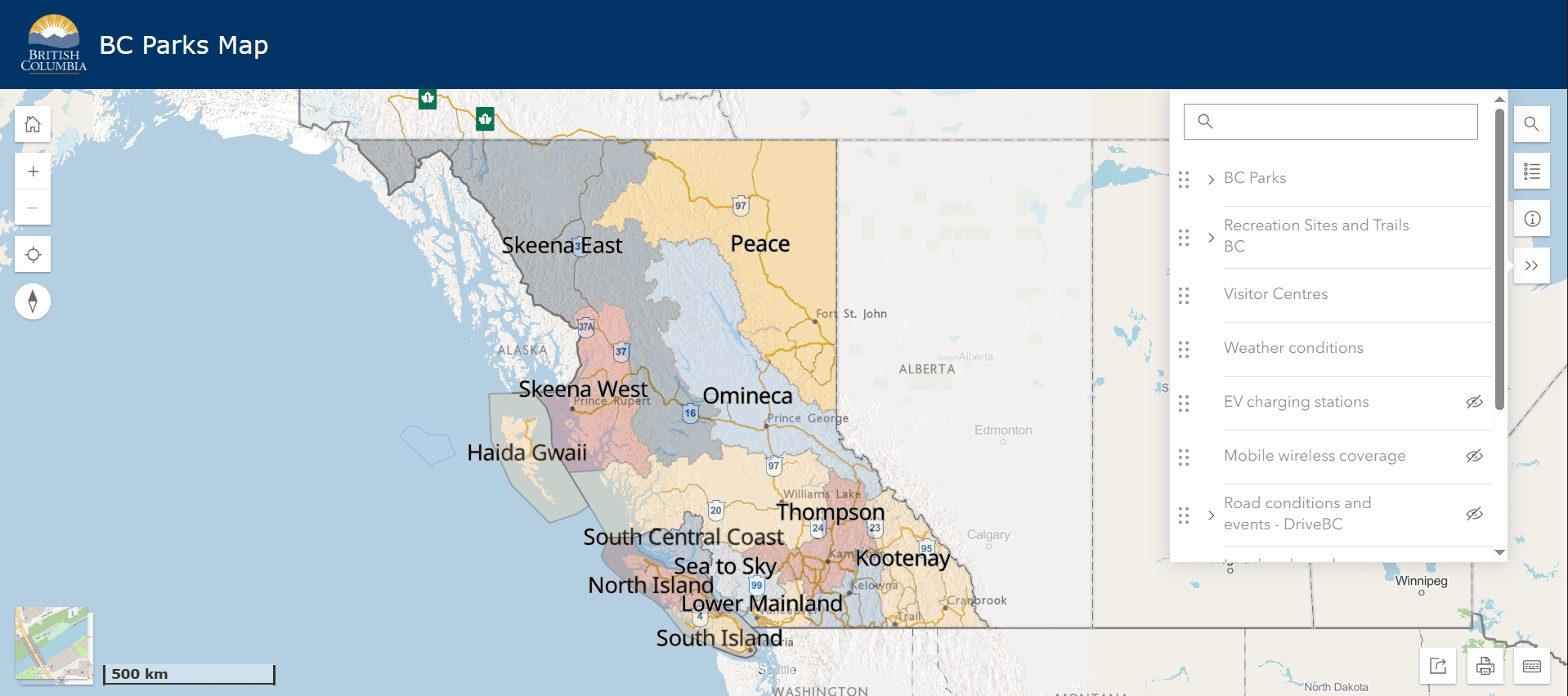
Use the ‘layers’ menu to show or hide:
- BC Parks boundaries
- Recreation Sites and Trails B.C. locations
- Parks Canada boundaries
- Local municipal parks and green spaces
- Highway conditions and closures from DriveBC
- B.C. visitor centres
- Weather conditions
- EV charging stations
- Cell phone coverage
- Evacuation alerts and orders
- Recent earthquakes
- Tsunami notifications
Advanced map
The advanced map has all the information the BC Parks map has, plus more detail, advanced data layers, and mapping tools. These can help you discover more information about BC Parks, create your own maps, and analyse spatial data.
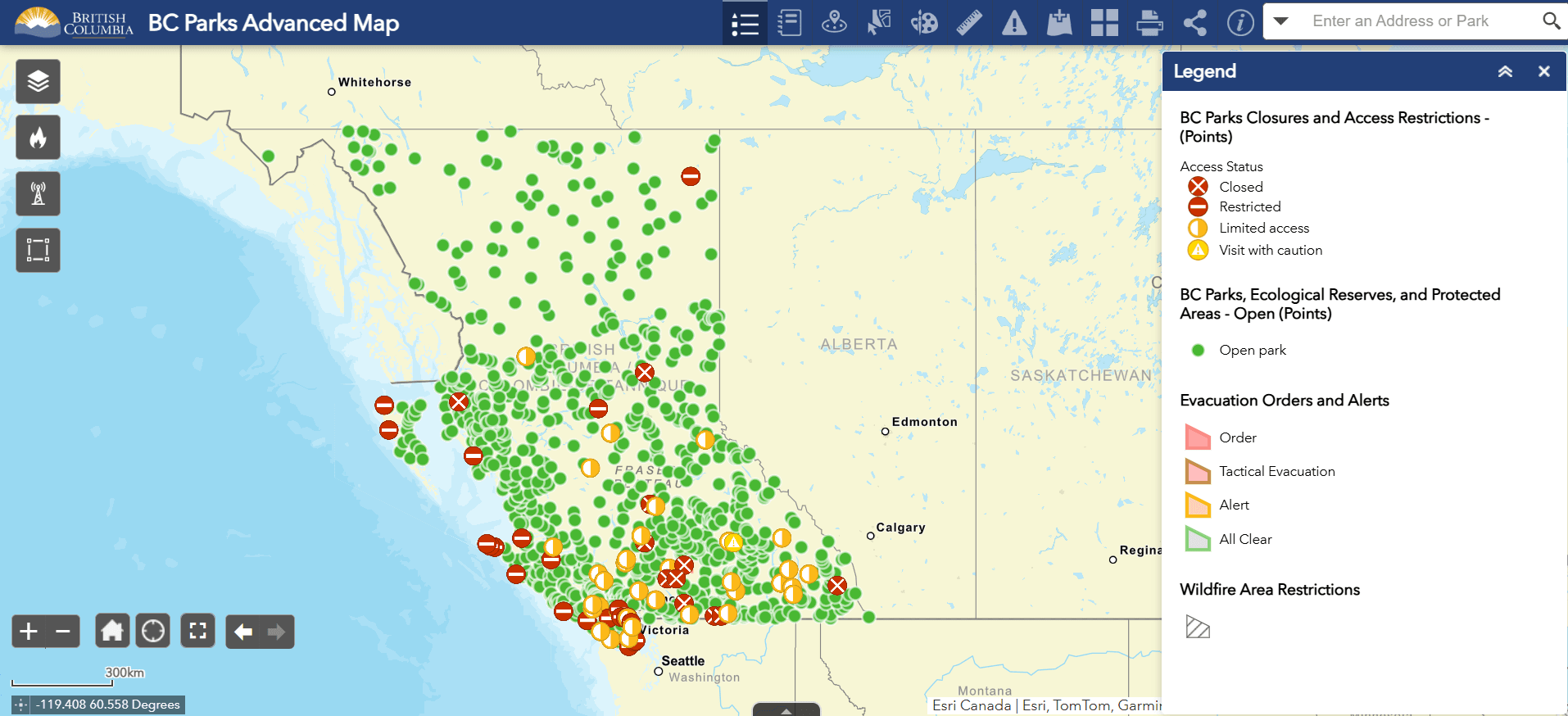
Parks and protected area layers:
- All open BC Parks or Recreation Sites and Trails
- All BC Parks or Recreation Sites and Trails with closures and access restrictions
- BC Parks park, ecological reserve, and protected area boundaries
- BC Parks conservancy boundaries
- National park boundaries
Emergency and wildfire layers from BC Wildfire Service, BC Air Quality, and DriveBC:
- Evacuation orders and alerts
- Wildfire locations
- Wildfire perimeters
- Wildfire area restrictions
- Fire zone boundaries
- Fire centre boundaries
- Air Quality Health Index stations
- Air monitoring stations (PM2.5)
- Highway conditions and closures
Boundary layers:
- B.C. visitor centres
- Natural resource districts, regions, and areas from B.C. Ministry of Forests
- B.C. regional districts
- Tourism regions from Destination BC
- Emergency management and climate readiness
Map tools:
- Detailed legend
- Park closure info summary
- Parks near me
- ‘Select’ tool that enables actions like exporting data to CSV and viewing an attribute table
- ‘Draw’ tool to add simple graphics and text
- Measurement tools
- Incident analysis widget that uses a buffer radius to retrieve data about the area
- ‘Add data’ tool for adding more layers from the BC Data Catalogue
- Basemap gallery
Disclaimer
Although every effort has been made to provide accurate information and locations, the Government of British Columbia makes no representation or warranties regarding the accuracy of information from this map, nor will it accept responsibility for errors or omissions. Data may not reflect the current closure situation, and therefore should only be used for reference purposes. Access to and/or content of this map may be suspended, discontinued, or altered, in part or in whole, at any time, for any reason, with or without prior notice, at the discretion of the Government of British Columbia.