Hiking is a popular pastime in Mount Assiniboine Park. For your own safety and the preservation of the park, obey posted signs and keep to designated trails. Shortcutting trails destroys plant life and soil structure. Please check the park advisories for trail bulletins.
- Check the current trail conditions report before heading out
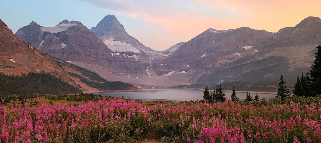
Day-hiking trails
- Assiniboine Lodge to Og Lake: this is 5.6 km of easy hiking.
- Assiniboine Lodge to Gog Lake: at 1.8 km, this is a short and easy hike.
- Assiniboine Lodge to Nub: moderately demanding.
- Assiniboine Lodge to Mount Cautley: a strenuous, uphill workout is promised by this 4.8 km hike.
- Assiniboine Lodge to Wonder Pass Viewpoint: it's 5.6 easy km along this hike.
- Assiniboine Lodge to Windy Ridge: hikers looking for a good cardio workout can hike the strenuous 5.7 km to Windy Ridge.
- Sunburst Lake to Rock Lake: this is 11.3 km of moderate hiking.
- Sunburst Lake to Elizabeth Lake: at 1.7 km, this is a moderately demanding hike.
- Sunburst Lake to Wedgewood Lake: this moderate hike stretches for 5.1 km.
Sunshine Meadows area also offers a number of excellent day hikes. Starting at the Sunshine Ski Village in Banff National Park, various loop trails traverse representative alpine meadows and lakes in the boundary area of Mount Assiniboine Provincial Park. The meadows in this area are very sensitive. Please use extreme care at all times and stay on the trails.
Longer hiking trails
Highway 93 to Magog Lake
The trail starts at the junction of the Vermilion and Simpson Rivers near Highway 93, about 56 km north of Radium Hot Springs; it follows the Simpson River to its junction with Surprise Creek.
Distance travelled is approximately 10 km, and for experienced hikers under good conditions, the travel time is estimated at 2-3 hours.
From this point, one trail follows Surprise Creek via Rock Lake to Ferro Pass (a distance of about 11 km and an estimated travel time of 2-3 hours); the Mitchell Meadows campground is about 1.5 km from Ferro Pass and the Magog Lake Campground is about 5-6 km farther along.
Another trail continues along the Simpson River through Golden Valley and the Valley of the Rocks and along Og Creek to Magog Lake (distance travelled is 32 km, the elevation change is 1,250 metres, and the maximum elevation is 2,287 metres).
The risk of grizzly bear encounters between Scout and Porcupine Camps on the Simpson River Trail is higher than in other areas of the park.
Spray Reservoir to Magog Lake
Access to the trails entering the park originate from the Spray Reservoir road located south of Canmore, Alberta. The road leads south from Canmore for approximately 15 km to the junction of the Smith Dorian Highway. Follow the Smith Dorian Highway for approximately 39 km to the turn-off marked Shark Mountain. There is a parking lot located 7 km from this turn-off.
The trail to the park starts here and leads along the shore of Watridge Lake, crossing two bridges before meeting the Bryant Creek Trail (in Banff National Park). From this point the trail follows Bryant Creek to Assiniboine Pass (distance travelled is 21 km, estimated hiking time is 6 hours).
Banff National Park offers several campgrounds and a primitive sleeping shelter along Bryant Creek. Visitors choosing to stay in the Bryant Creek Shelter or camp in Banff National Park are required to have a backcountry permit. Visitors can reserve the backcountry permit and obtain up to date trail information for Banff National Park at 403 762-1556. Trail reports and detailed backcountry trip planning information for Banff are also available on the Banff National Park website.
Magog Lake is 4 km farther, and should take one hour to reach. Elevation change for this hike is 520 metres, and the maximum elevation is 2,195 metres.
An alternative trail follows Bryant Creek and skirts Marvel Lake on its way to Wonder Pass (22 km, approximately 6 hours). Magog Lake is a further 4.5 km, and can be hiked in just over an hour. Elevation change for this hike is 700 metres, and the maximum elevation is 2,378 metres.
Highway 93 to Magog Lake via the Mitchell River
This little-used trail starts beyond a mine on the Mitchell River. To reach the trailhead follow Settlers Road from Highway 93 in Kootenay National Park for about 14 km and cross the Kootenay River. Follow a good logging road along the Cross River for 18.4 km and turn left up the Mitchell River. Parking is located about 6 km past Baymag Mine.
Beware of large ore trucks hauling on weekdays. High clearance vehicles are recommended for access. Just above the crusher a 4x4 road leads from the property and stops abruptly at a steep grade.
The trail starts at the base of this hill and follows the Mitchell River to Wedgewood Lake and then to Magog Lake (distance of hike is about 30 km, and hiking time is about 8 hours; elevation change is 1,100 metres). Although the trail crosses the Mitchell River in numerous locations it is not necessary to make all the crossings, as they are connected by short and very easy bushwhacks. Stay on the east side to the ford (see map) then cross over to the west.
Sunshine Ski Village to Magog Lake
The access road to Sunshine Village is 10 km west of Banff on Highway 1 in Banff National Park. Public vehicle traffic is permitted to Bourgeau parking lot only, a distance of 9 km.
From this point, visitors may hike 6 km to Sunshine Village. From Sunshine Village the trail leads to Magog Lake via Quartzridge, Citadel Pass, Golden Valley and Valley of the Rocks (a distance of 27 km, with an estimated hiking time of 8 hours, an elevation change of 488 metres and a maximum elevation of 2,408 metres.
Day-hiking routes
There are three informal day-hike “routes” heading out from the core area of the park that have evolved over the years. For the most part, these routes are without trails, but they do offer tremendous opportunities to view the park. We recommend that only hikers with good bushwacking and compass-reading skills attempt these hikes.
Sunburst Valley: From Nublet to the Nub, descend the ridge leading down to Elizabeth Lake. From here there are several options: 1} continue to Sunburst Lake via trail; 2}walk Chuck's Ridge and connect with Ferro Pass Trail and then to Cerulean and Sunburst Lakes; 3} follow Elizabeth Lake Trail to Ferro Pass Trail and complete the circuit via Cerulean and Sunburst Lakes.
Og Valley (East): Follow the trail to Og Pass and then continue along the trail to Windy Ridge, descending from the ridge via the smooth rock slope to the north end of Og Lake, then following the trail back to your starting point.
Og Valley (West): Follow the trail to Og Lake, branch off and head for either: 1} the pass between Jones Hill and Nub, or 2} the ridge at the eastern toe of Jones Hill. Either route brings you out into Nub Basin. From here pick a route down through to the main valley.