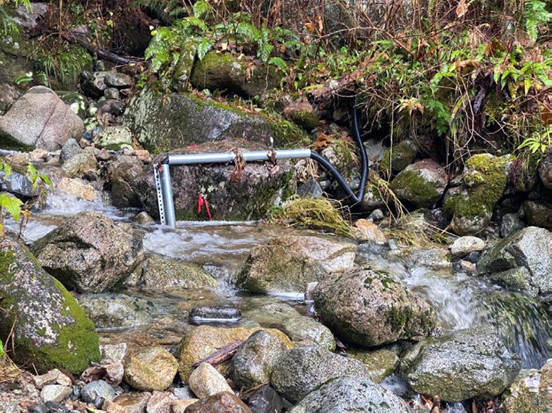
Above and belowground alpine plant responses to climate change and increasing recreational traffic in the Nch’kay region (Garibaldi Provincial Park)
Chelsea Little, Nina Hewitt, Courtney Collins, Noémie Boulanger-Lapointe, Hannah Marton, Elena Le, Paul English, Kaitlyn Croy, Côme Beauquier
The first big part of our project is about how human recreation, including trampling by hikers, affects alpine and subalpine plants. Recreational trails in mountain areas like Garibaldi Provincial Park are seeing more visitors than ever, and we are working to understand how foot traffic, invasive plant species, and a warming climate are changing fragile alpine meadows. This research helps BC Parks staff make informed decisions and design trails and infrastructure to protect these iconic ecosystems.
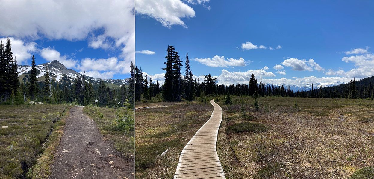
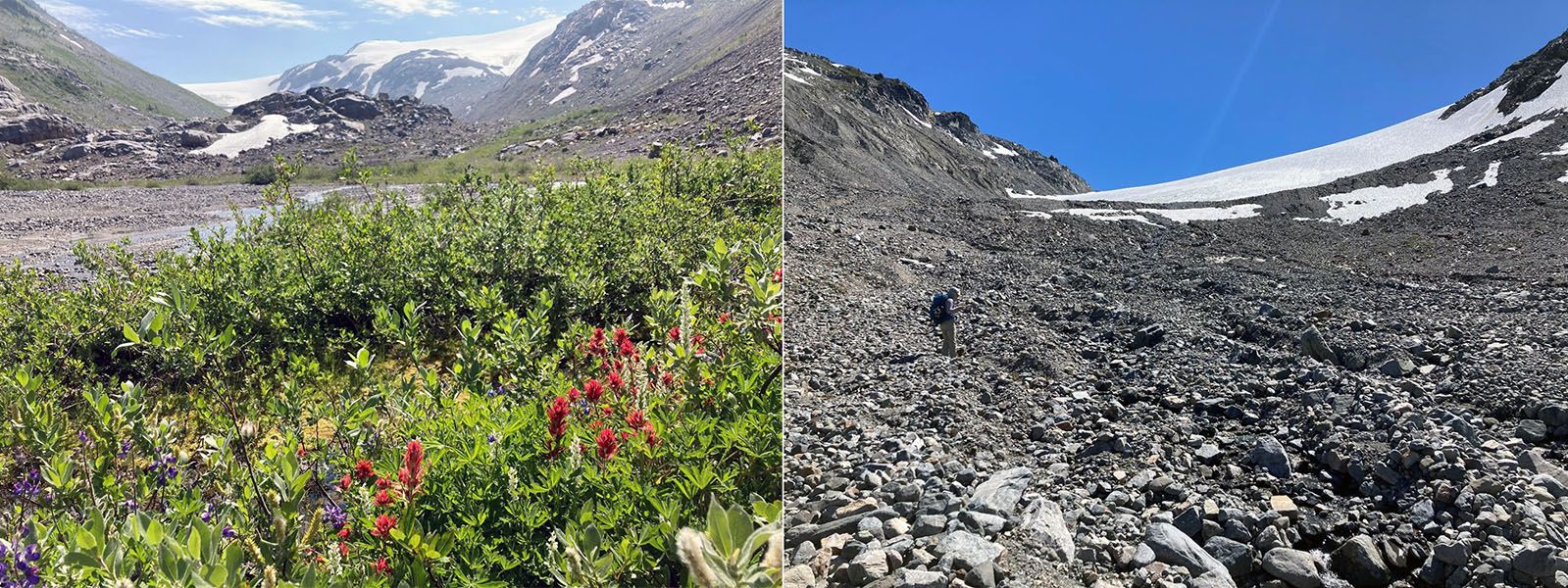
A major project last summer was conducting plant surveys in two valleys in Garibaldi Provincial Park where glaciers are rapidly shrinking. As glaciers retreat due to climate change, they expose new land that plants gradually colonize over decades — but the patterns of that colonization aren't always predictable. This research project tracks how plant communities establish and change in newly exposed terrain, helping us understand what such valleys might look like in the future.
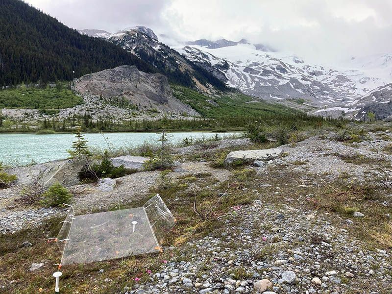
Finally, BC Parks Living Lab funding helped us maintain a long-term climate warming experiment in Garibaldi Provincial Park. Every summer for four years, we have constructed warming chambers out of plexiglass that warm the subalpine vegetation by a couple of degrees Celsius, mimicking future climate conditions. We are planning extensive surveys of these plots in summer 2026, which will reveal how years of warming affect vegetation. Insights from this experiment will allow BC Parks staff to predict what vegetation will look like decades in the future, and manage accordingly.
Tools for Connecting Thermal Refugia
Eric Saczuk
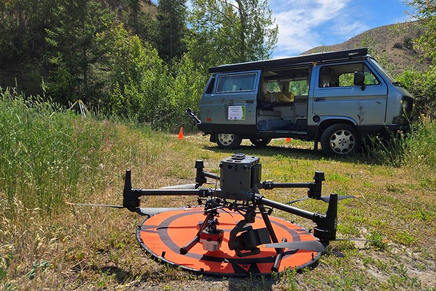
This research focused on the use of drone technology to make accurate maps of the lower 3km of the Tranquille River. Different sensors on board the drone were used to collect information about both the river and its surroundings to help BC Parks staff make informed decisions about the natural and build environment in the ecological reserve. Drones can capture data using light visible to our eyes, such as colour images. They can also capture data in wavelengths we cannot see, like heat and infrared energy. Analyzing these data using different software can help Parks staff make better-informed decisions about vegetation health, water temperature and erosion potential along the river.
State and fate of Overlord Glacier and associated downstream consequences
Gwenn Flowers, Chloe Monty, Jeff Crompton, Brian Menounos
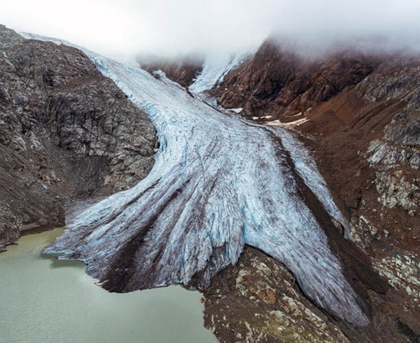
This project targets some of the most well-loved and well-travelled glaciers in the Whistler–Pemberton region to assess their current state of health and make projections of how and how fast we expect them to change in the future. These changing glaciers are agents of landscape evolution, important contributors to runoff, which affects downstream ecosystems and infrastructure, potential sources of hazards such as glacier lake outburst floods, and popular destinations for summer and winter recreation. Overlord Glacier, one of the jewels of the Spearhead–Fitzsimmons Ranges, has been the focus of our recent observational campaign. We have used geophysical methods (radar, sonar and lidar) to measure glacier thickness, map bathymetry (depth of the lake), and monitor surface elevation changes from year to year. These baseline data will be used in computer models to help us better understand how glaciers interact with the lakes that form in the wake of their retreat, and what future changes might be in store as Overlord and the surrounding glaciers diminish in our warming world.
Drivers and dynamics of wildfires and encroachment in Churn Creek Protected Area
Jill Harvey, Andrea Robinson, Kassidy Herrick
As part of a series of four projects, this year’s work looked to answer on the question “how will forest-grassland ecotones recover following the 2021 wildfire in Churn Creek Protected Area?” Alongside the Stswecem’c Xget’tem Guardians in 2023, researchers established 30 monitoring plots in an area affected by the 2021 wildfire. They placed markers in the ground and collected the initial data on vegetation regeneration from circular plots around the markers. This year, they returned to resample the same plots and see how different plants regenerated post-wildlife.
Datasets are still being analyzed for 2025. An increase in overall percent cover and species richness across most functional groups is evident between the first set of observations (2023) and the 2025 data collection.
On average, plots burned at a high severity had a greater increase in species richness than plots that burned at moderate or low severity. The greatest increases in richness were observed for forbs and grasses. A notable increase in the number of species observed in 2025 (particularly for forbs and grasses in this case) is evident.
Planned analyses include comparisons between 2023 and 2025 dataset for all functional groups and modelled as a function of Composite Burn Index (CBI).
Snow in Mountains (SiM): Berg Pass Alpine Snowpack and Weather Observatory
Joseph Shea
When it comes to weather in the mountains, the old adage says “if you don’t like it, wait five minutes”. But in extreme events, it can be important to know exactly what’s happening in alpine areas in real-time. Extreme snowmelt and unprecedented rainfall at the tail end of the 2021 heat dome event resulted in the evacuation of hundreds of stranded hikers from Mount Robson Provincial Park as trails flooded and bridges washed away. Over longer timescales, mountain snowpacks and glaciers are on the front lines of climate change, but we have little information about the changes occurring in alpine regions.
With the support of the BC Parks Living Labs program, the Canada Foundation for Innovation, and the British Columbia Knowledge Development Fund, the Snow in Mountains (SiM) project will install a real-time snowpack and weather station near Robson Pass in Mount Robson Provincial Park to support park management, public safety, and ongoing conservation and scientific research. Lead researcher Dr. Joseph Shea of the Mountain Snow Hydrology Lab (www.moshlab.org) at the University of Northern British Columbia will coordinate the equipment purchase, testing, and installation, and is aiming to have the real-time data available by mid-June 2026.
Located inconspicuously off the trail that leads to Snowbird Pass near the world-famous Berg Lake, the station will record weather data such as temperature, precipitation, snow depth, and snow water equivalence (SWE), which will be sent hourly via satellite to a public dashboard. Mount Robson park staff will use weather information from the station to support decisions about park operations and have advance warning of potentially dangerous conditions for park visitors. Ironically, as there is no cell service in the park, backpackers will not be able to access the data without help from the outside world! However, as another other old saying goes, forewarned is forearmed – and the Robson Pass SiM station will provide advance warning for park and visitor management while supporting ongoing studies of how snowpacks and glaciers in the region are changing - and will continue to change - in the face of climate change.

Five-Year Post-Wildfire Impacts on Invasive Species at Skaha Bluffs Park
Lauren Erland
In 2022, researchers initiated a project to understand how wildfire-derived plant growth regulating chemicals (karrikins) may accumulate in soils after wildfires and impact ecosystem recovery and plant community composition, two years after the Christie Mountain Wildfire. Researchers hypothesized that karrikins released in smoke during wildfires accumulate in Okanagan soils and either induce or inhibit germination depending on species adaptations. Karrikins were detected in soils sampled from different sites at Skaha Bluffs Park, and germination experiments in in vitro culture settings found that invasive species, including sulphur cinquefoil had modified germination rates in response to exposure to karrikins.
Low to medium severity burns, like prescribed burns, have increased species diversity after 5 years, and increased presence of pinegrass, while the two invasive species do not have a strong response to fire severity. Soil karrikin concentrations and chemical diversity shift over time but are persistent with the most common species.
Soil karrikin levels are correlated with the presence of some native species, including fire associated species and may contribute to post-fire community composition. Seeds from native and invasive species included in the study respond differently to karrikin exposure during germination. Preliminary results suggest that native species may be more responsive to some karrikins.
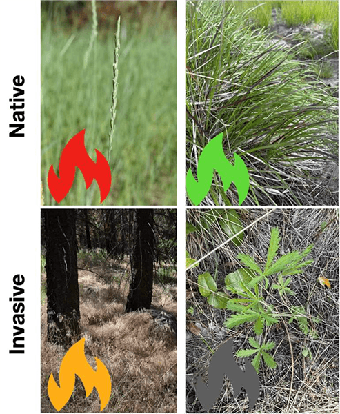
Summary of response of target species (top: bluebunch wheatgrass, pinegrass; bottom: cheat grass, sulphur cinquefoil) with red indicating a negative response, green positive response, grey no response and orange a mixed response.
Hydrological Modelling for Climate Resilience in Philips River Watershed
Younes Alila, Xu Jian (Joe) Yu, Jangar Tsembel, Henry Pham
This is the first year of a five-year program, with efforts focused on equipment installation and initial data collection. Full outcomes will develop as data accumulates and Distributed Hydrology Soil Vegetation modeling (DHSVM ) advances. For conservation values, the project enhances ecosystem resilience by identifying climate-driven streamflow changes such as floods and droughts to protect fish habitats. Simultaneously, it is establishing long-term monitoring capacity via BC Parks-funded stations that aid habitat restoration and vulnerability mitigation from logging impacts. For recreation values, it improves the safety of activities, like wildlife viewing, by predicting flood and drought risks for maintaining trails and boating access. It also promotes sustainable experiences by ensuring resilient habitats for salmon observation along with educational programs on climate effects. Regarding cultural values, the research strengthens Indigenous-led stewardship by integrating Kwiakah traditional knowledge systems, fostering reconciliation via OCAP (Ownership, Control, Access, Possession) principles, and supporting co-management decisions that honor cultural priorities in land use and ecosystem protection.
As data collection continues, BC Parks can start integrating preliminary insights by:
- incorporating real-time streamflow and weather data from the stations into existing park dashboards for ongoing hydrological trend tracking
- using model simulations (once available) to revise conservancy strategies that prioritize habitat restoration in flood/drought-prone areas
- sharing findings via workshops or reports to enhance staff training on climate-resilient practices including risk assessments for extreme events
- scheduling regular meetings with Kwiakah and researchers to apply insights to co-management decisions such as resource allocation or expansion proposals
- applying these to day-to-day operations by adjusting recreational guidelines (e.g., trail closures during predicted floods) and incorporating them into annual budgeting for adaptive infrastructure.