Trail descriptions below offer a number of different hiking opportunities within the park, catering to all levels of hiking expertise.
Conditions and equipment
Conditions
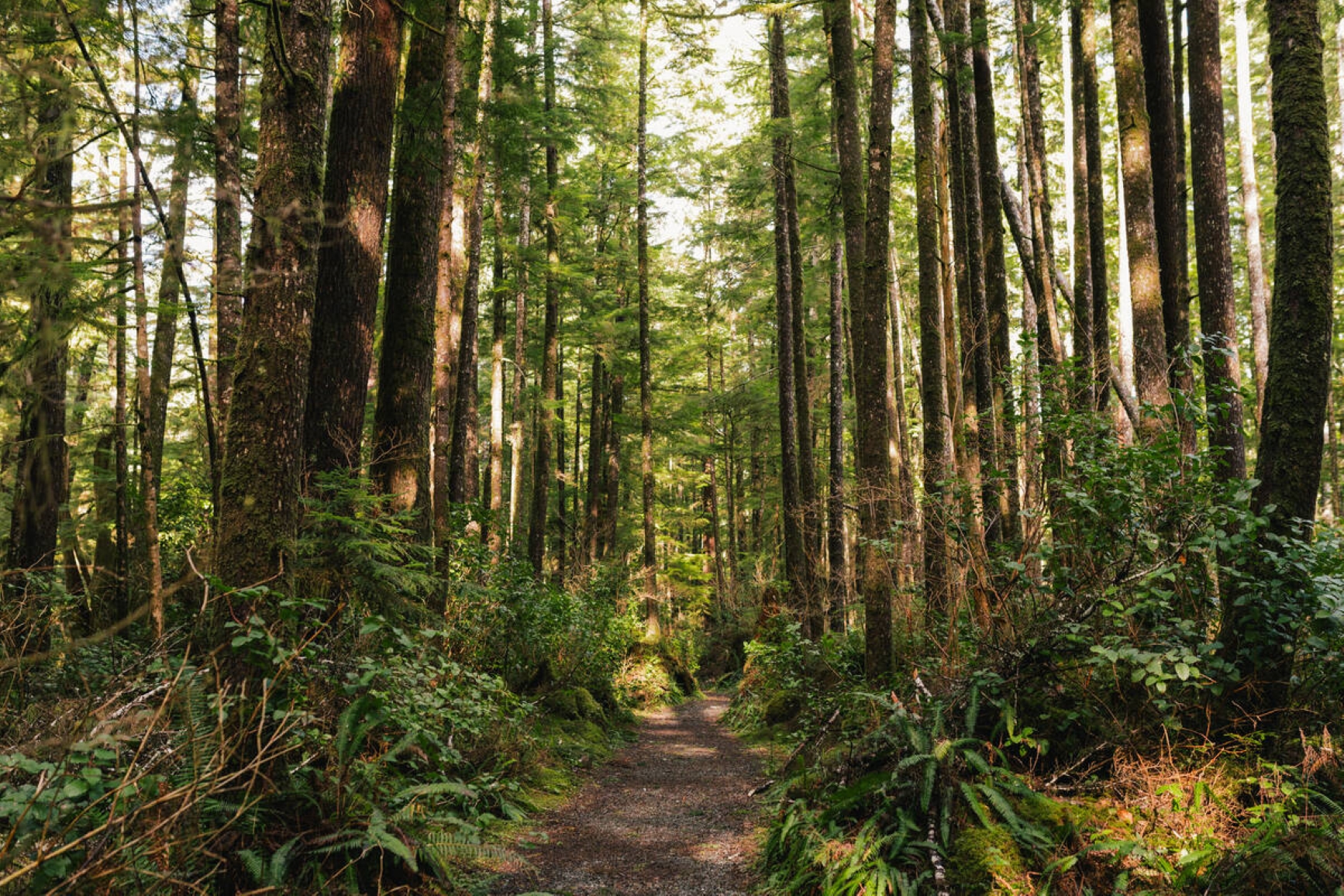
Many sections of the trails in Cape Scott Park are extremely muddy and difficult to traverse. Visitors should be equipped for wet weather. High-topped leather or rubber boots should be carried and proper hiking boots should be worn.
Note that there are sections of boardwalk on the trails, which can be extremely slippery when wet. Hikers should always use caution. Distances quoted for the trails are one-way only, and the approximate hiking times are geared to travel in good weather. Hiking times in inclement weather or when trails are muddy can be considerably longer.
The need to be prepared for adverse weather conditions in Cape Scott Park cannot be overemphasized.
Recommended equipment
- A good tent with a waterproof fly is imperative. It is simply not possible to expect to sleep outdoors here without adequate cover.
- Clothing, sleeping bags, and food should be kept in waterproof bags.
- A small primus-type stove should be carried for cooking purposes since suitable firewood is in short supply.
- Moleskin is a good preventative against blisters.
- Proper raingear is a must, as torrential rains can be expected at any time and may last for days on end.
- A basic first aid kit should be carried and insect repellent is recommended.
Coastal hiking safety
Hiking along the coastline is dangerous and not recommended unless following designated beach routes. Rogue waves are common along all beach sections in this area.
When hiking along beach routes, watch for suspended floats and buoys indicating access to trails. No attempt should be made to traverse undesignated coastal areas at high tide or when tides are flooding (incoming.)
Knowledge of the tides is essential for any visitor considering travel in the coastal area. Wilderness camping is not restricted to particular sites, although the more popular spots are near San Josef Bay and Nels Bight. Fresh water is available from streams at these sites, as well as at the east end of Nissen Bight and at Guise Bay. Boil, filter, or treat all drinking water before consuming.
Camping sites should be chosen carefully to prevent flooding from incoming tides, contamination of drinking water sources and to minimize damage to the environment.
When walking around old settlements, watch out for abandoned wells, broken glass and rusty nails. Standing structures are unstable. Please do not remove artifacts or disturb sites.
Hiking and camping guidelines
- Backcountry camping fees apply. Please pay in cash only at the self-registration booths located at either trailhead.
- Please practice Leave No Trace ethics, pack out what you pack in.
- Be bear aware. Bear encounters are common and should be expected in the park. Wolves and cougars are also present in the area.
- Water sources are few and far between. Ensure all hikers carry enough water to last them for at least two days at a time. All water should be boiled, treated or filtered prior to consumption.
- Use care on the access road and watch for logging trucks. Lock all vehicles and remove valuables.
- The Mt. St. Patrick to Lowrie Bay hiking route receives minimal maintenance. Beyond Mt. St. Patrick, visitors should be equipped with a topographical map and compass and be totally self-sufficient,
- There is no longer a campsite, hut or pit toilet at Donaldson Farm.
- There are now pit toilets located at Guise Bay and Fisherman River.
- The Federal Government dismantled the boardwalk and suspension bridges between the lighthouse and foghorn at the Cape itself.
Cape Scott core area trails
San Josef Bay
Length 2.5km from the trailhead. Average one way hiking time, 45 minutes.
Less adventurous hikers can leave the backpack at home and still get a taste of Cape Scott's unique terrain and spectacular Pacific Ocean vistas along this well-maintained gravel trail, which ends at the sandy shore of San Josef Bay in the southeastern corner of the park. Camping is allowed at San Josef Bay.
Eric Lake
Length 3 m from the trailhead. Average one way hiking time, 1 hour.
11 tent pads, located in the forest, are available on a first come, first served basis.
Fisherman River
Length 9.3km from the trailhead. Average one-way hiking time, 3 hours.
This is a popular spot for a picnic or rest. The river is also a good place to collect drinking water. Remember to boil, filter or treat all drinking water before consuming.
Nissen Bight/Nels Bight Junction
Length 13.1km from the trailhead. Average one-way hiking time, 4.5 hours.
The trail forks here, go straight ahead to Nissen Bight, or left to Nels Bight and Cape Scott. This is a popular camping destination with a beautiful sandy shoreline.
Nissen Bight
Length 15km from the trailhead. Average one-way hiking time, 5.5 hours.
This is a popular camping destination with a beautiful sandy shoreline.
Hansen Lagoon
Length 14.7km from the trailhead. Average one-way hiking time, 5 hours.
More than 100 years ago this area was the main settlement of the Danish pioneers, who grew crops and hay here on the open meadows. Remnants of the past include fence-posts along the old road and evidence of the early settler’s drainage systems.
Nels Bight
Length 16.8km from the trailhead. Average one-way hiking time, 6 hours.
With a beautiful sandy beach stretching more 2,400 metres long and 210 metres wide at low tide, Nels Bight is the most popular camping destination in the park. This area is also a good base for those exploring the rest of the park.
Experiment Bight
Length 18.9km from the trailhead. Average one-way hiking time, 7 hours.
This area has a beautiful sandy beach, however there is no year-round drinking water or facilities available.
Guise Bay
Length 20.7km from the trailhead. Average one-way hiking time, 7.5 hours.
Guise Bay is another beautiful beach that offers good camping possibilities. Lucky visitors may sometimes spot sea otters, an endangered species, in the bay.
Cape Scott
Length 23.6km from the trailhead. Average one-way hiking time, 8.5 hours.
The public may visit the lighthouse, which is outside the park and federally operated. The Federal Government has removed the suspension bridges and closed all public access between the lighthouse and foghorn at the Cape itself.
Sea Otter Cove and Lowrie Bay
Length 10km from the trailhead. Average one-way hiking time, 5 hours.
The route to Sea Otter Cove is accessed via San Josef Bay’s second (western) beach. From this point the route gains elevation quite quickly until you reach the summit of Mt. St. Patrick, which offers a spectacular panoramic view of the park.
From this point the route descends the mountain to Sea Otter Cove. Sea Otter Cove is only passable at mid to low tide. Only experienced hikers familiar with wilderness hiking and the use of a map and compass should go beyond Mt. St. Patrick. This route receives minimal or no regular maintenance.
North coast trail
The North Coast Trail is a 43.1km extension to the original Cape Scott trail. The total hiking distance is approximately 59.5km. The minimum recommended one way hiking time is 5 days, although, it is more commonly completed in 6 to 8 days. Hiking times are estimated for the average hiker in good physical condition in optimal weather conditions.
This is a very challenging route and is not recommended for inexperienced hikers.
Many sections require hikers to climb over or along fallen trees, to cross through deep mud, and to use fixed ropes to climb up and over steep sections. It is not recommended for those with a fear of heights. Consider hiking sections of the Juan de Fuca Marine Trail or the Cape Scott Trail to Nels Bight prior to attempting a trip to the North Coast Trail.
The trail is located in a wilderness area with minimal supplies or equipment of any kind. It is not regularly patrolled, so hikers should be completely self sufficient.
It is strongly recommended that all hikers carry a satellite phone or VHF radio in case of emergency.
Cell phones do not work in the park, and assistance may be days away in case of an accident.
The trail runs along the northern end of Vancouver Island spanning Cape Scott Park. It can be traversed east to west from Shushartie Bay to the eastern end of Nissen Bight or in reverse from west to east. The trail becomes progressively easier in the east to west direction. Access to the Shushartie Bay trailhead is by boat or floatplane only. There are currently no docking facilities. One water taxi service runs from Port Hardy during the summer season. Access to the western portion of the trail is from the San Josef parking lot at the Cape Scott trailhead. Shuttle service to the parking lot can also be arranged in Port Hardy.
The trail offers visitors a glimpse into wild, west coast ecosystems. The rugged trail passes through old and second growth Sitka spruce, hemlock and cedar forests, upland bogs, riparian areas, across sand, gravel and cobble beaches, and past sea stacks, rocky headlands, and tidal pools. The park is home to bald eagles, black bears, cougars, wolves, river and sea otters, mink, and an array of marine mammals. Sighting and encounters are common in the park, so visitors should use precaution.
Cape Scott Park is rich with First Nations history. Many signs of their historic presence are evident in the park. Please respect all cultural sites and leave them in an undisturbed state. Do not touch or remove any cultural items.
North coast trail overview
Shushartie Bay Campsite to Skinner Creek campsite
8.1km, 5 to 7 hours
This is the longest section of inland trail and is considered by most to be the most challenging portion of the entire oute. The trail reaches its maximum elevation of 225m along this section and passes mainly through upland bog ecosystems. This section provides sensitive habitats for amphibians, fish and invertebrates so please stay on the trail to avoid increased erosion and damage. There are stretches of boardwalk, but expect to be climbing up, over and around tree roots and stumps and through very muddy sections.
Three tent pads, a food cache, and a pit toilet are located on the hillside above the trailhead at Shushartie Bay; however, there is no water source at Shushartie Bay. If you are hiking from Skinner Creek, fill up your water bottles there.
There is a designated campsite at Skinner Creek with a pit toilet and food cache. There are no tent platforms but beach camping is possible.
Skinner Creek is the only good water source along this section of trail.
Skinner Creek Campsite to Nahwitti River campsite
2.9km,1 to 1.5 hours
It is possible to hike along the beach from Skinner Creek to Nahwitti River at low tide; however, this section can be very dangerous during high tides and can be virtually impassable. A rough inland trail can be used to bypass the beach if necessary. There is one section of inland trail to be used at all times. Hanging floats at the end of the beach identify the access point. Tide tables should be consulted before attempting to hike the beach section.
There is a campsite with four tent platforms, a food cache, and a pit toilet located at Nahwitti River.
The Nahwitti River can be used as a water source, but walk far enough upstream to avoid tidal influx.
Nahwitti River campsite to Cape Sutil campsite
5k, 2.5 to 4 hours
From the Nahwitti River camp the trail heads south on an easy trail to the first cable car crossing. The ladders to the cable car platforms are very steep and caution should be used especially in wet weather. No more than two people, or 600lbs, should use the cable car at one time.
Portions of the next section of trail are through dense forest where the trail can easily be lost. Look for trail markers to identify the path. Be aware that some areas may have old flagging tape delineating old logging tracks and are not marking the trail.
The trail then heads up and over what is known as Long Leg Hill before descending down the longest set of stairs in Cape Scott Park. The stairs are slippery when wet.
The beach west of the Nahwitti stairs is impassable at high tide due to a rocky promontory. Wading past this section at high tide should not be attempted due to the risk of being swept out to sea. Plan your hike accordingly by consulting a current tide table. Camping at the eastern edge of the beach is possible during certain times of year if necessary. Ensure that you are set up well above the high tide line. There is a good water source located immediately east of the rocky promontory.
The last stretch to the Cape Sutil campsite is characterized by steep, rugged headlands with extensive rope work. If necessary, remove your pack and lower it with the ropes provided. The section is very slippery and a fall will likely result in serious injury.
Cape Sutil itself lies outside of the park boundary in a First Nations Reserve. It is the former site of the First Nations village of “Nahwitti” and is rich in cultural heritage. Access to the reserve is restricted, so please refrain from visiting the Cape.
There is a ranger yurt located at Cape Sutil that is staffed with Park Facility Operators (PFOs) from June 15th to Labour Day weekend. The yurt is open the rest of the year for emergency use by the public. Please ensure you leave the yurt in better condition than you found it. Do not wear caulk boots in the yurt, and use the food caches located behind the structure.
Beach camping is possible at Cape Sutil (there are no tent platforms at this site). There is a pit toilet located 50 metres up the trail at the eastern end of the beach. There is a food cache located behind the ranger yurt and another one by the pit toilets.
There are only ephemeral water sources along this section of trail. Pack water from Nahwitti River or Irony Creek (depending on direction of travel).
Cape Sutil campsite to Irony Creek campsite (Shuttleworth Bight)
7.8km – 4 to 6 hours
Pocket beaches and rocky headlands characterize this section of trail. Keep your eyes open for floats and buoys hanging near inland trail access points. Many beach sections can be traversed at low tide, but look for the adjacent inland routes during high waters. More rope work and steep sections can be expected along this stretch.
There is a creek ford immediately west of the Irony Creek campsite. Passage can be difficult under high flows (e.g. in early spring), and the rocks in the area are slippery at all times of year, in all weather conditions.
There is a campsite located on the west side of Irony Creek in the middle of Shuttleworth Bight. There are four tent platforms, a food cache, and a pit toilet at this location.
Irony Creek is the only good water source along this section of trail.
Irony Creek (Shuttleworth Bight) campsite to Laura Creek campsite
11.8km, 4 to 7 hours
This section is predominantly coastal. Hikers will find themselves exposed to the effects of the open ocean with little in the way of cover in inclement weather. Camping is possible along the pocket beaches northwest of the cable car but no facilities are provided. Consult tide tables to ensure high tides do not hinder progress along this section.
There is a short, easy, inland section to the second cable car crossing located at the Stranby River. Look for signs of the old corduroy settler’s road on the west side of the cable car.
Beach sections alternate between, sand, gravel and cobble while passing by innumerable tidal pools and rock shelves exposed at low tide. This section is teaming with wildlife. Bald eagles perched in old growth Sitka spruce, and black bears foraging in the beds of seaweed, are quite common.
There is another creek ford east of the Laura Creek campsite. It is generally easy to cross, but rocks in this area are very slippery.
There is a designated campsite with four tent platforms, a food cache, and a pit toilet located approximately 200 metres west of Laura Creek.
Laura Creek is the only good water source along this section of trail.
Laura Creek campsite to Nissen Bight
7.5km, 2.5 to 4 hours
This is the last section of inland trail before reaching the Nissen Bight trailhead. It begins and ends with easy sand beach walks before climbing back into the forest to traverse around the Nahwitti Cone. Boardwalks and stairways are common, but many sections are still very muddy. Look for the old settler’s road along this section, and stop for a break at Laughing Loon Lake – the North Coast Trail’s only lake (not suitable for swimming).
There are three significant creek crossings along this section. The first and third (when heading east to west) have bridges with handrails, but the second, located at Dakota Creek, does not. Do not attempt to walk across the log spanning the second creek. It is very slippery and unsafe. Either ford the creek or shimmy across the log.
Beach camping is possible on the entire length of Nissen Bight. A pit toilet and food cache are located at the western end of the beach, and another food cache at the eastern end.
The water source is located at the eastern end of the beach near the North Coast Trail trailhead (approximately 900 metres from the pit toilet and food cache). At low tide walk approximately 50 metres east along the rocks, or at high tide take the inland trail which forks to the east off of the NCT near the beach.
Nissen Bight to Cape Scott trailhead
15.4km, 5 to 7 hours
This section is part of the original Cape Scott trail. It is the easiest section of the North Coast trail and also the most maintained. There are many boardwalk sections, but still expect to get your feet muddy. Look for remnants of the Danish settlers along the entire route.
There is a campsite with three tent platforms and a pit toilet located at Fisherman River at kilometre 9.3 (from the Cape Scott trailhead). There is no food cache at this location.
There are eight tent platforms, a food cache, and a pit toilet located at Eric Lake at kilometre 3 (from the Cape Scott trailhead). Access to the lake is on the west side of the campground.
Fisherman River is the best water source along this section of trail.